
Thorong La Pass: Altitude, Location, Difficulty & Crossing Tips
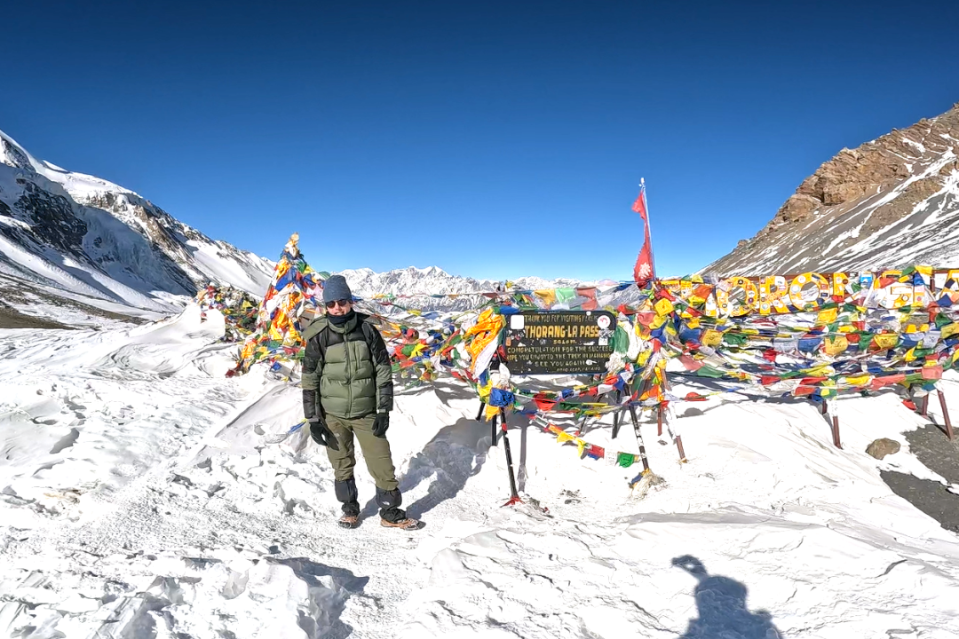
Table of Contents
I. Introduction
There’s a moment on the Annapurna Circuit when trekkers feel a surge of excitement and exhaustion at the same time. The breathing becomes heavy here, and the wind starts to blow strongly. You can hear your own heavy breath, and when you look around, you see prayer flags snapping against a brutally blue sky. This is Thorong La Pass(5,416 meters/17,769 feet) – the highest trekking pass on Earth.
Ordinary trekkers can cross this mountain pass without needing mountaineering skills, ropes or oxygen tanks. Thorong La Pass is the crown jewel of the Annapurna Circuit Trek in Nepal. It is one of the hardest parts in the entire trek. Trekkers feel a great mountain achievement when they cross and descend to a lower altitude.
Here we will provide detailed information that you should know, including altitude, location, difficulty, and essential tips for a safe crossing.
II. What & Where is Thorong La Pass? (Location & Geography)
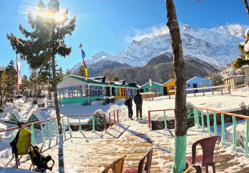
Thorong La sits deep in the Annapurna Himalayas of central Nepal. It forms the high mountain link between Manang District to the east and Mustang District to the west. It’s the geographic and psychological midpoint of the Annapurna Circuit. It’s the point where trekkers cross from one valley system into an entirely different world.
It is the highest point on the entire circuit; the pass is the reason the trek is planned this way.
Every acclimatization day, every short warm-up hike, and every early bedtime exists because of Thorong La. After crossing it, the rest of the trek is a long, satisfying descent.
What makes the crossing so memorable is the sheer contrast in scenery. You climb out of the Manang side through glacier-fed valleys and alpine meadows. Then you top out on a windswept, rocky saddle that looks more like the Tibetan plateau than Nepal. Drop down the other side toward Muktinath, and the landscape turns dry, dusty, and canyon-like. It’s a completely different climate zone within a single day’s walk.
III. How High is It? (Altitude & Acclimatization)
The official elevation of Thorong La Pass is 5,416 meters (17,769 feet) above sea level. It is higher than the famous Everest Base Camp 5,364 meters). At this altitude, the oxygen is half(roughly 50% less) of what you can find at sea level. Due to thin air, it makes it inconvenient to stay for a long time. Every step you take at high altitude increases the heart rate, and even experienced trekkers find themselves out of breath doing very little.
This isn’t something willpower fixes – it’s basic physiology. It affects everyone differently, regardless of fitness level.
Acute Mountain Sickness, also called altitude sickness(AMS), is the real risk. When you catch altitude sickness, headaches, nausea, dizziness, and fatigue trouble the body. If it is not treated, then it can progress into two much more serious conditions: High Altitude Pulmonary Edema (HAPE). Both are life-threatening situations which need immediate medical treatment.
The good things you can reduce the altitude sickness risk by following these acclimatization tips:
- Spend real time in Manang (3,540m): Many tour agencies build itineraries that include rest days here. It is an important day that you should never skip and rush before pushing higher.
- Take an acclimatization hike: Short hikes to “Gangapurna Lake” or “Ice Lake“ help your body to adjust to high altitude.
- Follow the golden rule “climb high, sleep low”: Gaining altitude during daytime and at the end of the day sleeping at a lower altitude is one of the most effective ways to acclimatize safely.
IV. How Difficult is Thorong La Pass? (Difficulty Breakdown)
Climbing up to Thorong La Pass is strenuous and physically demanding, but it is not technically hard. You don’t need to use the rope, ice axe, or mountaineering gear. Although it is non-technical, it doesn’t mean it’s easy. Here are the different factors that make it a real challenge:
- Extreme cold and unpredictable weather: Temperatures around the Thorong La pass remain cold and freezing most of the time. If the weather turns bad, it results in heavy snowfall, making crossing the pass almost impossible. Strong winds and icy paths also add to the challenge.
- Long and exhausting trekking day: Trekkers need to walk for a continuous 8 to 10 hours before sunrise to reach the pass before afternoon and for safe descent. Such extreme walking is physically and mentally demanding and tests your stamina.
- The combination of fatigue and altitude: At high altitude, due to physical tiredness, the thin air affects concentration, decision-making, and mood. Rather than pushing, they make the wrong decision to go backward.
Special note: You don’t need to be a super athlete or experienced mountaineer to cross Thorong La. However, good stamina for walking, cardiovascular fitness and high-altitude trekking experience are highly recommended.
V. The Crossing Day: What to Expect
The start: The journey of crossing Thorong La Pass starts from either Thorong Phedi (4,450 m) or High Camp (4,850 m). We leave the teahouse early in the morning, around 3:00 AM to 4:00 AM.
The Ascent: We set out by keeping our headlamps on and walking under the stars, battling the freezing wind and steep, rocky switchbacks.
- Thorong Phedi to High Camp: about 1 kilometer (0.6 miles) distance, taking about 45 to 1.5 hours of steep climbing.
- High Camp to Thorong La Pass: about 4 kilometers (2.5 miles) distance, taking 3 to 4 hours of steady uphill hiking.
Reaching the top: We reach the top of the Thorong La Pass between 7:00 AM and 9:00 AM, depending upon your walking pace and starting time. From the top, you can enjoy panoramic Himalayan views of:
- Annapurna Massif
- Gangapurna
- Dhaulagiri Range
- Tilicho Peak
- Surrounding Glaciers
- The Arid Mustang Plateau
- Distant Tibetan Landscapes
The Descent: After enjoying emotional reward and taking a lot of photos and videos for memories, you will begin descending toward the lower elevations. From the pass, the trail drops more than 1,600 meters to Muktinath over just a few hours. Walking on a steep descending trail is also brutal. It tests your knees and quads after you put all your energy into reaching the top of the pass.
VI. Essential Tips for a Successful Crossing
Train Before You Go:
If you are a regular trekker or hiker, continue your routine. However, if you are a beginner, follow a solid training plan to build endurance. Train at least 1 to 2 hours daily for 3 months in advance before joining the trek.
- Build a Fitness Base: Brisk walking, jogging, stair climbing, and strength training.
- Improve Cardiovascular Fitness: Running, cycling, swimming, and aerobic exercises.
- Build Leg Strength: Squats, lunges, step-ups, and calf raises.
- Increase Endurance: Long-distance walking, hiking, and uphill walking.
- Practice With a Backpack: Gradually walk with a 7–8 kg backpack to prepare for trekking conditions.
- Train on Different Terrain: Practice walking on uphill, downhill, rocky, and uneven trails.
- Allow Recovery: Include rest days and stretching to help your muscles recover and prevent injuries.
Choose the Right Season for trekking:
The safest time to cross the Thorong La Pass is during spring (March–May) and autumn (September–November). During this season, the weather remains favourable for crossing without adding much challenge. Visibility becomes better, chances of snowfall remain low, and temperature generally ranges from -5°C to 10°C around the pass. Things to do even if you are crossing in the best season:
- Weather conditions can deteriorate anytime at high altitude, so bring all weather conditions trekking clothes and gear.
- Check the weather forecast before heading out for the crossing pass.
- Be prepared to adjust your itinerary if the weather remains unfavorable.
Things to Pack
Packing the right things is essential to survive in all kinds of weather conditions. While packing, we need to keep in mind that if you take a porter, they will carry a maximum of 20 kg. One porter is mostly divided among two trekkers. And if you need to carry around a 7 to 8 kg backpack to keep your essential items like passport, documents, toiletries, water, etc.
Things to Pack:
- Passport and documents
- Permit
- Trekking poles
- Pack suitable clothing for all kinds of weather conditions.
- Toiletries
- Water bottle
- Snacks
- Personal belongings
Hire a Guide or Porter:
You can hike the Annapurna Circuit solo without a guide. But if you are a beginner or trekking for the first time, hiring a professional guide and porter has a lot of safety benefits. They help to spot AMS symptoms, monitor health conditions, navigate safely and provide assistance in case of emergency.
- Guide hire cost: USD 30- 35 per day
- Porter hire cost: USD 25 per day
Learn Altitude Sickness
Never ignore the early symptoms of AMS, such as headache, dizziness, or nausea. Drink 3 to 4 liters of water daily and eat high-carb meals (dal bhat is your best friend). Avoid alcohol and sleeping pills. If you experience AMS symptoms, inform your trekking guide immediately and descend to a lower altitude. If symptoms worsen, seek immediate medical treatment.
Purchase Right Travel and Health Insurance Policy
High-altitude Himalayan trekking adventure is risky, and to protect yourself financially for the unseen events, it is important to have the right insurance policy. Your insurance policy must cover:
- High-altitude trekking
- Emergency medical treatment
- Helicopter evacuation
- Altitude sickness (AMS)
- Hospitalization and medical expenses
- Emergency rescue and evacuation
- Trip cancellation or interruption
- Coverage up to the maximum altitude of the Annapurna Circuit
Choose Best Trekking Agency
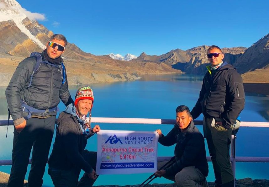
There are lots of local and international trekking agencies that operate the Annapurna Circuit Trek in Nepal. The International Agency alone cannot run a trek inside Nepal without collaborating with a local tour agency. For the best experience and budget friendly choose local agencies like High Route Adventure, which are registered under the Nepal Government.
Frequently Asked Questions(FAQs)
Where is Annapurna Circuit Trek located?
- The Annapurna Circuit Trek is located in the Annapurna Conservation Area of north-central Nepal in Gandaki Province of Nepal.
How long does it take to complete the Annapurna Circuit Trek?
- The standard Annapurna Circuit trek takes around 12 to 16 days to complete. If a side trip to Tsum Valley is done, it takes around 21 days to complete.
How much does it cost for the Annapurna Circuit Trek?
- Annapurna Circuit trek costs around $800 to $2,500 USD per person, depending on the itinerary days, level of accommodation, transportation and service. Group discount is also provided by most of the trekking agencies.
Can beginners cross Thorong La Pass?
- Yes, beginners can cross the Thorong La Pass with reasonable fitness and stamina. However, proper acclimatization, preparation, and a gradual itinerary are important because of the high altitude.
Can I cross Thorong La Pass in winter?
- Winter crossing is possible, but heavy snowfall, strong winds, and freezing temperatures can make the trail closure risky.
What happens if the weather is bad at Thorong La Pass?
If the weather remains bad during the time of crossing Thorong La Pass, you need to wait for a suitable time for crossing. Therefore, keep your itinerary flexible and allow extra time for the pass crossing.
Final Say
Crossing Thorong La Pass is challenging, but it is a rewarding and life-changing journey in the Annapurna Region. From Thorong La Pass, you can witness amazing views of Annapurna Peaks, nearby high peaks including Gangapurna, Chulu West, and Khatung Kang. Also view the Kali Gandaki Valley, fluttering prayer flags, chortens, etc.
Planning for the Annapurna Circuit trek in Nepal? Then contact us for expert guidance, a customized itinerary, and a hassle-free trekking experience. Our team is here to help you plan your journey from start to finish.
- Email: info@highrouteadventure.com
- Phone/Whatsapp: +977-9851058664
-
Flash Flood Sweeps Away Dozens of Homes in Gorkha, Nepal
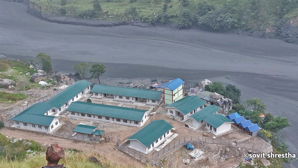
KATHMANDU, Nepal — A sudden and severe flash flood tore through the Budhi Gandaki River basin in Gorkha district on Sunday morning, washing away approximately 35 houses and triggering widespread destruction in the mountainous Manaslu and Tsum Valley regions. According to local authorities and disaster management officials, no human casualties have been reported thus far, though…
-
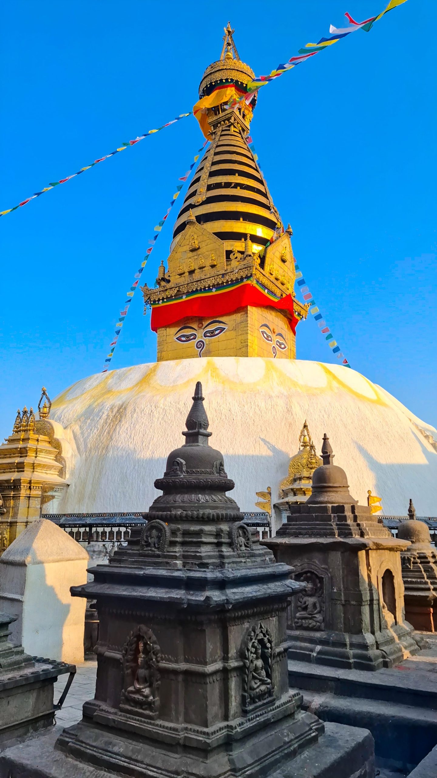
Swayambhunath Temple, Kathmandu
Imagine standing above the chaos of Kathmandu. Honking horns fade below you. A gleaming white dome rises ahead. Two enormous painted eyes gaze calmly in every direction. Prayer flags flutter in the Himalayan breeze. This is Swayambhunath, one of the most extraordinary places in Nepal. Visitors know it as the “Monkey Temple” because hundreds of…
-

North Goa vs South Goa: Which Is Better for Your Holiday?
Amongst the places that are highly popular in terms of beaches, weather, culture, and ambiance in India is Goa, which is known to possess some of the most beautiful beaches in India. The idea of Goa being famous for its beaches, which can be used by tourists for entertainment in North Goa while South Goa…