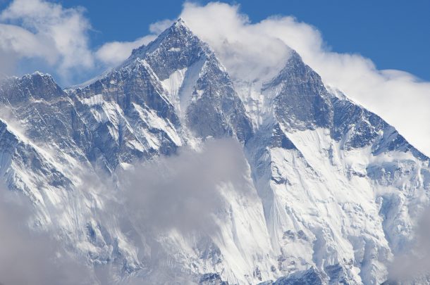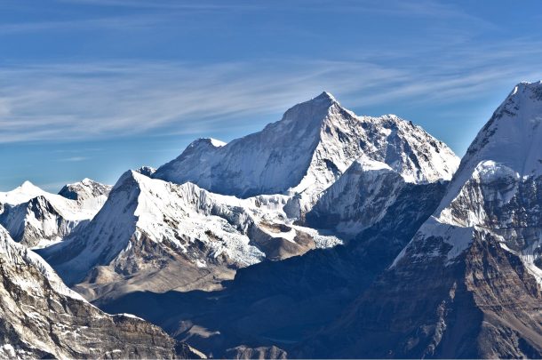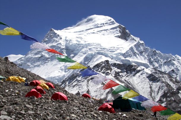

Standing at the summit of Dhaulagiri(8,167 m) , the world’s 7th-highest peak, is a dream for many climbers. This mountain lies in the Myagdi district of western Nepal, northwest of the city of Pokhara. It is part of the greater Himalaya mountain range and fifth highest peak in Nepal.
Mount Dhaulagiri, popularly known as white mountain, is the highest mountain in the Dhaulagiri range. The Dhaulagiri Range stretches approximately 120 km (75 miles) from the Kali Gandaki River in the east to the Bheri River in the west. Mount Dhaulagiri I is buttressed by five major ridges. The standard route is the Northeast Ridge, which was first ascended by a Swiss-Austrian-Nepali expedition in 1960.
In this expedition, you will follow the standard route by driving from Kathmandu to Dhaulagiri and then trekking for several days in Dhaulagiri trekking route to reach the Dhaulagiri Base Camp. From the base camp, your climbing period starts. Here you will do rotation through Advanced Base Camp and higher camps, including Camp I, Camp II, Camp III, and Camp IV, before making the final summit push.
From the summit of Dhaulagiri I at 8,167 m (26,795 ft), it offers the impressive panoramic views of the Dhaulagiri Range, Annapurna Range, Nilgiri Range, Tukuche Peak, and the Kali Gandaki Gorge. Also, the aerial view of the remote landscapes of Mustang and the Tibetan Plateau is equally stunning to watch from here.
Reaching these 8,000-meter peaks of Nepal is a grand achievement in mountaineering. After the summit, you will return to Kathmandu through the famous Jomsom village. You will take a flight from Jomsom to Pokhara and drive to Kathmandu to conclude your Dhaulagiri Expedition journey.
Early in the morning, our private vehicle will pick you up from your hotel. The taking a scenic drive from Kathmandu via the Prithvi Highway to Pokhara. From riding along the Pokhara–Baglung Highway through Kusma to reach Beni. Then follow the Beni–Darbang Road along the Myagdi River to reach Darang. The drive is long, so we prepared to leave early in the morning, around 4 to 5 AM. Carry snacks, water and wear comfortable clothes.
Your trekking journey starts from Darbang. Today you will walk toward Dharapani, following the Myagdi Khola. The trail passes through the forest, small settlements and hillsides. Once you reach Dharapani, you will check in to the teahouse and stay overnight.
Leaving the farming village of Dharapni, it's now time to head toward Muri. Then you will pass through the Takum and Sibang, traditional settlements predominantly inhabited by the Magar community. En route, you can enjoy the scenic view of Gurja Himal (7,193m), Putali Himal, and parts of the magnificent Dhaulagiri massif in the distance. Crossing the suspension bridge over the Dhara Khola, you will reach Muri, one of the larger Magar settlements.
Leaving the hillside Magar village after breakfast, it's now time to head toward the Bagar. We walk down the riverbed, cross the suspension bridge and climb to reach. From here, you can witness the impressive view of Mt. Ghustung (6465m) South face. Then, walking through the bamboo and rhododendron forests and crossing the Mahatala and Naura village you will reach Bagar.
After breakfast in Bagar today, we will leave for Doban, which is a small, seasonal herder/trekking settlement. Walking along the bank of the Myagdi Khola river, you will pass through a quiet, peaceful forest of rhododendron, pine, and bamboo. Once you reach Doban, you will check in at the teahouse and spend the night.
After breakfast, we leave Doban and descend toward Konaban Khola. We cross the stream and continue our walk on the bank of the raging Myagdi Khola. Then, crossing through the beautiful rhododendron and pine forest arrive at exposed landslide areas. Walking carefully through this rugged section, we continue our journey, enjoying views of cascading waterfalls and crossing several wooden bridges. Eventually, we arrive at Sallaghari, our overnight destination.
After breakfast, we leave Sallaghari and walk through the alpine zone, making our way to the Italian Base Camp. Following the Myagdi Khola, you will enjoy the scenery of Dhaulagiri I, Dhaulagiri II (7,751m), and Manapathi Peak (6,380m). As you gain altitude, you will notice a change in landscape from lush tropical to alpine landscape. Once you arrive at the Italian Base Camp, you will check in at the very basic teahouse. There are only 2 teahouses here. Above here, there are no teahouses.
After breakfast, we will go to the teahouse and walk through the moraine landscape above Dhaulagiri Glacier to reach the Japanese Camp. En route, you will find memorials sites set up for those who lost their lives attempting Mt. Dhaulagiri. Upon reaching the Japanese Camp, an impressive view of Dhaulagiri Southwest flank and Manapathi Himal welcomes you. Then our team will set up a tent for you, and you will stay overnight in a tented camp.
After breakfast, we will leave Japanese Camp early in the morning to avoid the changing weather as we cross the glacial moraine. Crossing carefully over the lateral moraine of the Chhonbardan Glacier, we will reach Dhaulagiri Base Camp. Reaching upon Dhaulagiri Base Camp, you can witness a grand view of the north face of Dhaulagiri dominating the sky.
During this climbing period, first you will complete the rotation to adjust your body to high altitude. Then, after monitoring the weather forecast from the Base Camp, you will begin your summit push.
Once you stand at the top of Dhaulagiri, you are surrounded by breathtaking panoramic views in every direction. To the east, you can admire the Annapurna massif, Kali Gandaki Gorge, and Tukuche Peak, while the west opens toward the vast Dhaulagiri Himal range and remote mountain valleys. Looking north, you can see the rugged Hidden Valley and distant landscapes toward Dolpo. At the same time, the south offers impressive views of the Myagdi Khola valley and the immense southern face of Dhaulagiri.
After the summit, you will pack your expedition equipment, remove waste and leave for the Base Camp.
Now it's time to descend into the remote Hidden Valley. Once you reach the French pass you will witness the prayer flags fluttering in the sky, with panoramic views of Dhaulagiri I, Tukuche Peak, and Mukut Himal. Crossing the pass, once you reach the Hidden Valley, the landscape turns into a vast, high-altitude plateau resembling the Tibetan Plateau.
Leaving early in the morning after breakfast, after about 2 hours of walking, you will reach Dhampus Pass. From the pass, enjoying the best view of the Dhaulagiri massif, Annapurna and the Nilgiri ranges, we will continue toward Yak Kharka. Reaching upon Yak Kharaka you will stay in the teahouse surrounded by green grass.
Leaving Yak Kharka, we will stay either in Marpha/Jomsom. After several days in the high mountains, you can finally enjoy a well-deserved hot shower and relax.
Enjoy a 20-minute scenic flight from Jomsom, and you will land in Pokhara. Celebrate the successful summit of Dhaulagiri in lakeside Pokhara with your team.
Return to Kathmandu either by road/flight. Once you reach Kathmandu, we will transfer you back to your hotel and conclude the Dhaulagiri Expedition.
Difficulty Grade: ED (Extremely Difficult), according to the French Alpine grading system.
Mount Dhaulagiri is considered a highly technical and demanding peak compared to mighty Everest. So climbers who want to participate in this expedition must have previous mountaineer experience and knowledge of using technical climbing equipment. They must be proficient in using crampons, ice axes, ropes, ascenders, descenders, and other essential climbing gear.
For the successful summit of Mount Dhaulagiri, we request that our climber climb at least one technical high-altitude peak before attempting this expedition. Suitable preparation peaks include Manaslu, Cho Oyu, Ama Dablam, or other 6,000 m to 7,000 m mountains. This helps you understand the weather conditions of the Nepalese Himalayas, adapt to high-altitude environments, and build technical skills and confidence.
The ideal weather window for climbing Dhaulagiri I (8,167 m/26,795 ft) is during the spring pre-monsoon season, specifically from April to May. During this period, the weather is generally more stable, high-altitude winds are less intense, and snow conditions are more favorable for climbing. The optimal time for the summit push is between late April and mid-May.
Another potential climbing window exists in the fall season (September to October). However, conditions during this time can be colder and more unpredictable, with shorter weather windows and stronger winds. Therefore, autumn is often more suitable for experienced climbers and teams who have prior high-altitude expedition experience.
Here are the required permits that you will need to participate in this Dhaulagiri expedition:
Note: High Route Adventure will arrange these permits on your behalf. To arrange the permit, we need your scanned passport, passport-size photograph and travel insurance.
On this expedition journey, first you will stay in the teahouse until Italian Base Camp. Above here, you will stay in the tented camp set up by our expedition team. While you stay in the teahouse accommodation, you will get the facilities of sharing room, toilets, Wi-Fi, charging and a variety of meals. Remember, the facilities become more limited at higher altitude.
While staying in the tent during the summit journey, you can expect basic meals like DalBhat, bread, egg. You will stay in a simple, cozy tent without the facility of wifi, mobile network, hot showers, and charging.
For the Dhaulagiri Expedition, all the climbers must obtain comprehensive travel and mountaineering insurance. While purchasing the policy, make sure it includes:
24/hour emergency assistance is provided for the Dhaulagiri Expedition by High Route Adventure. For the emergency situation, our climbing team will work with local authority, rescue teams to arrange the helicopter evacuation. However, remember the rescue operation heavily depends upon the weather conditions. Our team will cooperate with your insurance and make the necessary arrangements.