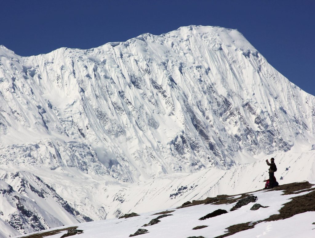
Tilicho Peak Expedition - 21 Days

Trip Facts
Duration 21 Days
Max Altitude 7,134 meters
Trip Grade Challenging
Best Season spring (March to May) and autumn (late September to November)
Meals Breakfast, Lunch And Dinner
Accommodation Teahouse/Tent
Highlights

Tilicho Peak Expedition Highlights

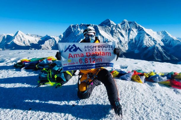
  • Reach the summit of Tilicho Peak at an altitude of 7134M / 23,405ft ft.
  • From the top of Tilicho Peak, witness the 360 view of Annapurna, Dhaulagiri, Manaslu, and surrounding Himalayan ranges.
  • Enjoy breathtaking views of the Kali Gandaki Valley, one of the world’s deepest gorges.
  • Admire the beauty of the glistening aqua-blue waters of Tilicho Lake, situated near the base of the peak.
  • Trek along the famous Annapurna Circuit Trail, surrounded by breathtaking mountain scenery.
  • Experience the diverse cultures of Gurung, Magar, Manangi, and Bhotia communities practicing Tibetan Buddhism.
  • Discover hand-carved mani walls, spinning prayer wheels, white chortens, and colorful fluttering prayer flags along the trail.
  • Stay in local family-run teahouses and enjoy traditional Nepali dishes such as dal bhat, momo, and thukpa.
Overview

Tilicho Peak Expedition Overview

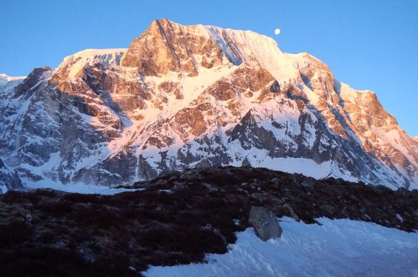
If you are searching for a technical peak climbing experience in Nepal, the Tilicho Peak Expedition is the best option for you. Located in the Annapurna Region of Nepal, north of Manang, it stands at an incredible altitude of 7,134 meters. 

Your expedition journey starts with a scenic drive from Kathmandu to Chame. From here, you will follow the famous Annapurna Circuit trail. The route passes through Pisang, Manang, and Khangsar before arriving at Tilicho Base Camp. En route enjoy the spectacular view of the mountain village, traditional stone houses, unique culture, and the Marshyangdi River. 

Along the trekking route, there are plenty of beautiful teahouses where you will stay after a day of trekking. Here you will get the opportunity to meet locals, interact with them and understand their culture, tradition, and Himalayan lifestyle. 

From Tilicho Base Camp(4,150 m), your climbing journey starts. From here, our expedition team will conduct acclimatization and climbing rotations before guiding you safely to the summit of Tilicho Peak. 

The ascent follows the northwest shoulder, a route first ascended in 1978 by French climber Emmanuel Schmutz. Navigating through the steep snow, ice slopes, and mixed rock sections, we move from Base Camp to Camp I(5800 m), Camp II(6200 m) and the summit.

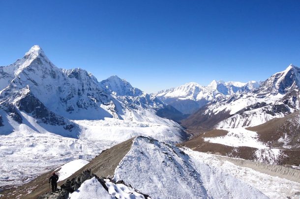
From the summit of Tilicho Peak, enjoy breathtaking views along the snow-covered northeast ridge, with the Kali Gandaki Valley to the west, the Marshyangdi Valley to the east, and the hidden kingdom of Mustang stretching to the north. The mountain views include Annapurna, Dhaulagiri, Manaslu, and the surrounding Himalayan peaks. 

Then, returning safely to Chame, you will take a drive and get back to Kathmandu and conclude your journey. Upon completion, after arriving in Kathmandu, we will provide a Department of Tourism (DoT) climbing certificate. This official Tilicho Peak summit certificate supports applying for future expeditions like Mount Everest.

Tilicho Peak Expedition Cost for 2027/2028

Our Tilicho Peak climbing package starts at USD XXX. We also offer discounts for groups. Additionally, group joining is available; please contact our tour operator for available dates that match your schedule.

Itinerary

Tilicho Peak Expedition Itinerary

Duration: 9 to 10 hours
Distance: approximately 240 km

Early in the morning, we will pick you up from your hotel and begin our scenic drive to Chame. We drive through the Prithvi Highway from Kathmandu to Muglin enjoying the views of the Trishuli River and lush green hills. From Mugling, we continue toward Besisahar and then follow the Marsyangdi River Valley on the road to Chame. Today's drive will be around 9 to 10 hours. Be prepared for the long drive. Bring snacks and water bottles, and wear comfortable clothes. Our vehicle will stop in the middle of driving for lunch and a short break.

⛰ Altitude 2710 metres
🍽 Meals Dinner
🏨 Stay Teahouse
Duration: 6 to 7 hours
Distance: approximately 14 km

After breakfast in Chame, we started our hike toward Pisang, following the Marsyangdi River through gorgeous mountain scenery. The trail began with a suspension bridge crossing and continued through quiet pine and spruce woodlands.

We walked through the small town of Talekhu, and the trail gradually climbed through the forest. As we proceed, the valley gets more dramatic, with huge cliffs and harsh mountain vistas lining the trail.

After a couple of hours' walk, we arrive at Bhratang (2,850 m), a little village famed for its vast apple orchards. Here we break for lunch and enjoy the serene surroundings before heading toward Pisang.

The trail from Bhratang climbs steadily, passing the spectacular rock face of Swarga Dwari (Gateway to Heaven). Next, we head toward Dhikur Pokhari, where the valley opens up and offers amazing views of the surrounding mountains.

The scenery changes a lot as we reach Pisang. The lush forests go away, and the environment becomes drier and more rocky, typical of the higher Manang Valley.

Eventually we arrive in Upper Pisang (3,250 m), where we check into a small teahouse and enjoy a well-deserved break. If time and weather allow, we will tour the settlement and admire the surrounding Himalayan landscape.

⛰ Altitude 3300 meters
🍽 Meals Breakfast | Lunch | Dinner
🏨 Stay Teahouse
Duration: 7 to 9 hours
Distance: approximately 15.5 km

After breakfast, we start our journey from Upper Pisang (3300 m) to Manang (3540 m) along the beautiful upper trail, passing Ghyaru and Ngawal. This is one of the most rewarding sections of the Annapurna Circuit, with amazing mountain views, traditional communities, Buddhist culture and dramatic changes in the scenery.

The first section is Upper Pisang to Ghyaru (3,670 m). The trail zigzags rapidly up the mountainside through pine forests in a succession of hard switchbacks. The climb is tough, but Ghyaru is very much worth the effort. The town has panoramic views of Annapurna II, Annapurna IV and neighboring Himalayan ranges.

From Ghyaru we take a more pleasant high-altitude contour track to Ngawal (3,660 m). The trail climbs up the slope with wonderful views over the Marsyangdi valley. We pass traditional Tibetan-style stone dwellings and enjoy the quiet environment of the high mountain communities on the route.

From Ngawal, the trail descends gently to Braga (Bragha) at 3,470 m. As we enter the upper Manang Valley, the scenery becomes drier and rougher. Braga is an old village with traditional stone buildings and the spectacular Braga Monastery, one of the main cultural sites along the Annapurna Circuit. If there's time, we can stop for a little while and look around the monastery.

From Braga, we continue with a reasonably simple 2 km trek toward Manang (3540m). The trail traverses the valley level and leads us to Manang, the main hiking hub of the area. Stunning Himalayan peaks surround Manang, and it is a good area to stop and acclimatize before venturing into the higher reaches of the Annapurna Circuit.

On arrival, we check into our teahouse and have time to rest or tour the village.

⛰ Altitude 3519 metres
🍽 Meals Breakfast | Lunch | Dinner
🏨 Stay Teahouse
Duration: 2 to 3 hours
Distance: approximately 5–6 km

After breakfast, we go on an acclimatization hike from Manang to Gangapurna Lake. The hike takes approximately 2 hours round trip. During the hike, it offers spectacular views of Gangapurna, Annapurna III, Annapurna IV, and the surrounding peaks. The lake is situated at an altitude of around 3,900 m. After enjoying the scenery and taking photographs, we return to Manang.


⛰ Altitude 3519 metres
🍽 Meals Breakfast | Lunch | Dinner
🏨 Stay Teahouse
Duration: 4 to 5 hours
Distance: approximately 11 km

After breakfast, we leave Manang and head toward Khangsar and Tilicho Lake. We cross the Thorong Khola and follow an easy mountain track. The trail passes by old mani walls, small communities, and stunning canyon vistas. Upon reaching Khangsar Village, we continue past the traditional stone buildings. The trail soon begins to climb more steeply as we enter the rugged alpine environment. We walk past a small monastery before slowly ascending to Shree Kharka. Upon our arrival, we settle into a cozy teahouse and enjoy magnificent views of Gangapurna and the Annapurna range.

⛰ Altitude 4060 meters
🍽 Meals Breakfast | Lunch | Dinner
🏨 Stay Teahouse
Duration: 4 to 5 hours
Distance: approximately 8 km

After breakfast, we leave Shree Kharka and begin our walk to Tilicho Base Camp. The trail leads us through beautiful high-altitude meadows. We then ascend through a narrow, exposed area with steep scree and slopes prone to landslides, moving slowly and carefully across loose rocks and gravel. Along the way, we are rewarded with magnificent views of Khangsar Khang and other nearby peaks. After the final uphill stretch, we reach Tilicho Base Camp at an elevation of 4,150 meters. We settle into a simple teahouse, take a rest, and enjoy some hot tea.

⛰ Altitude 4150 meters
🍽 Meals Breakfast | Lunch | Dinner
🏨 Stay Teahouse
Duration: 07 -16
Distance: approximately 10 days

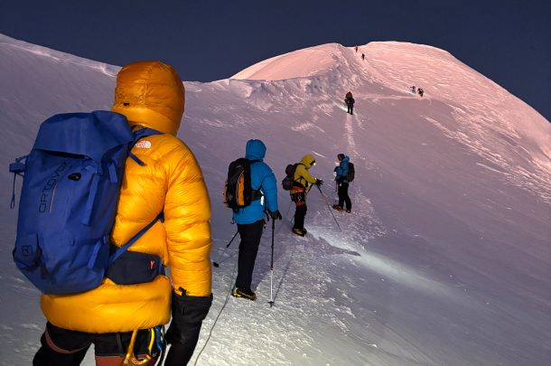
We start with a period of rest, followed by equipment checks, ice and snow training, and a traditional puja ceremony at Tilicho Base Camp. Next, we make rotations through Camp I and Camp II to acclimatize our bodies to the increasing altitude in preparation for the summit push. During the climb, we use fixed ropes on steep sections of snow and ice. 

After acclimatization, we begin our ascent towards Tilicho Peak, which stands at 7,134 meters. The route features challenging steep slopes of 55–60 degrees and technical sections. We pass through Camp III, located at approximately 6,600 meters, before reaching the summit. 

Once we celebrate our successful summit, we descend to a safer lower camp and continue our journey back.

⛰ Altitude 7134 meters
🍽 Meals Breakfast | Lunch | Dinner
🏨 Stay Tent
Duration: 4 to 5 hours
Distance: approximately 12 kilometers

We are now heading back to Khangsar. After breakfast, we leave Tilicho Base Camp. We descend through rugged alpine landscapes and cross the landslide section carefully. The trail gradually becomes easier as we lose altitude. We continue through mountain scenery and traditional settlements before reaching Khangsar Village. Upon arrival, we check into a teahouse and enjoy a well-earned rest.

⛰ Altitude 4150 meters
🍽 Meals Breakfast | Lunch | Dinner
🏨 Stay Teahouse
Duration: 4 to 5 hours
Distance: approximately 7 kilometers

After breakfast we leave Khangsar and head back to Manang. We pass through traditional stone house and main settlement of the upper Marsyangdi Valley.

⛰ Altitude 3519 metres
🍽 Meals Breakfast | Lunch | Dinner
🏨 Stay Teahouse
Duration: 7 to 8 hours
Distance: approximately 19 km

We pass through Braga enjoy the Himalayan scenery and retrace our step to Pisang.

⛰ Altitude 3200 meter
🍽 Meals Breakfast | Lunch | Dinner
🏨 Stay Teahouse
Duration: 4 to 6 hours
Distance: approximately 14km

After breakfast we follow the Marsyangdi River. We pass through several small settlements and traditional villages. We pass through forests and follow the well-established trail toward Chame.

⛰ Altitude 2710 metres
🍽 Meals Breakfast | Lunch | Dinner
🏨 Stay Teahouse
Duration: 9 to 10 hours
Distance: approximately 240 km

Our private vehicle will drive us from Chame back to Kathmandu. Upon arrival in Kathmandu, we transfer to your hotel and conclude our Tilicho Peak adventure.

⛰ Altitude 1400 meter

Build Your Own Adventure!

Collaborate with our specialists to create a unique itinerary.

Tilicho Peak Expedition Booking, Payment, Cancellation
  • Booking: To confirm the booking of the Tilicho Expedition with us, you need to send us an advance payment of 20% of the total trip cost. If any adjustment needs to be made, make sure to inform us during booking.
  • Payment: We accept payment through Debit Card/Credit Card, Mastercard, Connection IPS, Bank transfer.
  • Cancellation: For detailed information regarding cancellation, please check our company terms and conditions.
Things to Know

Notes

Tilicho Peak Expedition Difficulty

Difficulty grading: D+ (Difficile Plus), according to the French Alpine grading system.

Tilicho Peak is recognized as a remote climb of intermediate difficulty. Climbing this technical peak requires expertise in mountaineering skills and physical fitness. Here are the key technical challenges:

  • Steep Summit Push: The final summit push involves slopes ranging between 50 and 60 degrees, requiring strong crampon, ice-axe, and fixed-rope skills.
  • Terrain: The route features steep snowfields, ice pitches, glaciers, and exposed ridges that require careful movement.
  • Altitude: Reaching a summit height of 7,134 meters (23,400 ft) increases the risk of altitude sickness and other high-altitude effects.
  • Extreme High-Altitude Conditions: Low oxygen levels, freezing temperatures, strong winds, and rapidly changing weather can make the ascent more challenging.
  • Long and Demanding Summit Day: Climbing for 10 to 16 hours on the summit day is physically and mentally exhausting.

Preparation Tips for Tilicho Peak Expedition

Although Tilicho Peak climbing is difficult, it is manageable when climbers plan and prepare in advance. Here are some important tips to help you prepare for the expedition:

  • Physical Fitness: Focus on building cardiovascular endurance, strength, and stamina. Train for at least 6 months to 1 year, depending on your fitness level.
  • Practice High-Altitude Trekking: For progressive altitude experience, do trekking at least 5,000 - 5500 metres. It helps to adjust your body to lower oxygen levels. 
  • Master the technical skills: Develop essential mountaineering skills, including expertise with specialized gear, glacier travel, rope systems, and self-arrest safety techniques.
  • Train with a Backpack: Load your backpack and train your body to build core strength.
  • Mental Preparation: Prepare for the uncertainty, discomfort, extreme weather, and challenges that can arise during the climb. Be mentally prepared, patient, and determined throughout the expedition.

Best Time to Summit Tilicho Peak

The best window for the summit of Tilicho Peak is during Spring( March to May) Spring( (September to November). In spring, the longer sunlight hours, warmer temperatures, breathtaking mountain views, and easier steps in ice and snow make for ideal climbing conditions. 

In autumn,  the sharp views, high visibility, moderate daytime temperatures, and easy navigation make Tilicho Peak climbing more favorable. Also, Dashain and Tihar are celebrated during this season, which gives an opportunity to experience rich Nepalese culture.

Required Permits and Documents

The required permits for Tilicho Peak are:

  1. Climbing permit from the Department of Tourism(DOT)
  2. Annapurna Conservation Area Permit (ACAP)
  3. TIMS Card (Trekkers' Information Management System)

High Route Adventure will process the permit for you once you book the package with us. For processing, you need to send us a scanned passport, a medical fitness certificate and proof of medical and rescue insurance.

Food and Accommodation: What to Expect

On this Tilicho Peak expedition, High Route Adventure will arrange the accommodation for you. The accommodation is divided into two stages:

  • Teahouse: The mountain lodge where you will stay from Chame to Tilicho Base Camp during the trek. Inside the teahouse, you will get facilities such as a cozy room, a shared bathroom, WIfi, a hot shower and charging. A variety of Nepalese dishes and a few international dishes are available and are served in the communal dining area. 
  • Tented Camp: Our expedition group will set up tents in Camp I and Camp II. There will be our kitchen team to prepare basic Nepali dishes like Dalbhat, noodles, and soup. There will be a portable bathroom. There will be no facilities of mobile network, Wifi, and Charging here.

High-altitude Mountaineering Safety and Acclimatization Tips

  1. Acclimate gradually: Walk at your own pace, stay hydrated, and avoid alcohol, caffeine, and sleeping pills during the climb.
  2. Watch for altitude sickness: Use an oximeter to check your oxygen level above 3,000 meters. If you experience any symptoms of altitude sickness decent to a lower altitude. If symptoms worsen, seek immediate helicopter evacuation.
  3. Time your expedition: Choosing the right season increases the chances of a successful summit.
  4. Carry emergency gear: Carry first aid, personal medicine, headlamp, extra batteries, spare clothing, and other safety gear. 
  5. Monitor weather conditions: Mountain weather can change rapidly, even during the peak season spring and autumn). Check the weather forecast before heading out and during the climbing period.
  6. Purify your drinking water: Make sure to treat water by using a water purification tablet before drinking.

Travel Insurance That need to Cover

It is mandatory to have travel insurance for Tilicho Peak Climbing. You need to provide proof of insurance to obtain a climbing permit. While purchasing the insurance policy, make sure it covers:

  • High-altitude risk coverage up to 7,134 m.
  • Emergency helicopter evacuation
  • Medical treatment and hospitalization
  • Accidental injury and emergency rescue
  • Trip cancellation or interruption
  • Coverage for repatriation
  • Loss, theft, or damage to personal baggage and equipment

Emergency Rescue and Evacuation

During an emergency situation, helicopter evacuation will be provided in cooperation with your insurance company. The helicopter evacuation depends upon the weather, the climber’s location, and the accessibility of the area. Our expedition leader will cooperate with local authority, rescue operators to arrange evacuation plans as quickly as possible.
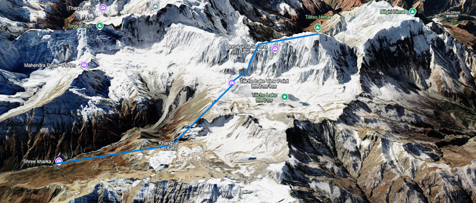
Map

Tilicho Peak Route Map

Altitude Chart

Equipment

While packing for the Tilicho Peak Climbing make sure to pack for both trekking and climbing. If you need to rent climbing gear, various equipment options are available in Thamel, Kathmandu. Let’s see what to pack for this expedition:

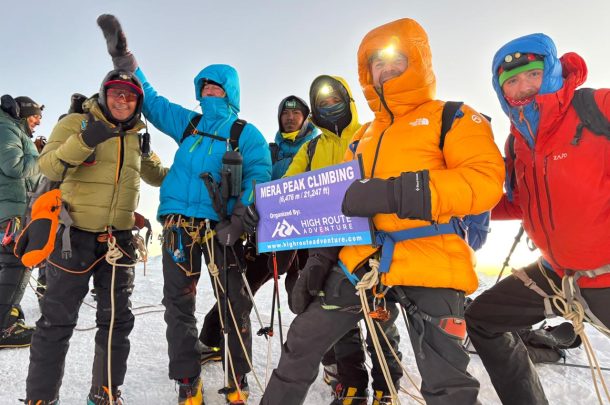
Trekking Equipment

  • Trekking backpack (40–50 L)
  • Duffel bag
  • Daypack (20–30 L)
  • Trekking boots
  • Camp shoes or sandals
  • Trekking poles
  • Sleeping bag suitable for high altitude
  • Headlamp with extra batteries
  • Water bottles or hydration system
  • Water purification tablets or filter
  • Sunglasses and sunscreen
  • Personal first-aid kit
  • Personal toiletries and hygiene items

Clothing

  • Moisture-wicking base layers
  • Fleece or warm mid-layer
  • Down jacket
  • Waterproof and windproof jacket
  • Waterproof trekking pants
  • Warm trekking pants
  • Thermal underwear
  • Warm gloves
  • Sun hat or cap
  • Warm woolen hat
  • Buff or neck gaiter
  • Wool or thermal socks
  • Gaiters

Technical Mountaineering Equipment

  • Mountaineering boots
  • Crampons
  • Ice axe
  • Climbing harness
  • Climbing helmet
  • Ascender (Jumar)
  • Descender
  • Carabiners
  • Prusik loops
  • Climbing slings
  • Mountaineering rope
  • Ice screws, if required
  • Belay device
  • Climbing gloves
  • Crampon-compatible gaiters

High-Altitude and Personal Safety Gear

  • Goggles
  • Glacier glasses
  • Face mask or buff
  • High-SPF sunscreen
  • Lip balm with SPF
  • Hand warmers
  • Emergency blanket
  • Personal medication
  • Basic medical and blister-care supplies
  • Small repair kit
  • Waterproof bags or dry bags
  • Power bank and charging cables
  • Camera and spare batteries

Optional Items

  • Satellite communication device
  • GPS device
  • Trekking watch or altimeter
  • Earplugs
  • Book or entertainment for rest days
  • Small personal snacks and energy bars
FAQs

FAQs of Tilicho Peak Expedition

  • Where is Tilicho Peak located in Nepal?

    Tilicho Peak, standing at 7,134 meters (23,406 feet), is located in the Annapurna region of the Nepal Himalayas, approximately 210 kilometers west of Kathmandu. It is the highest point of the "Great Barrier" ridge and rises directly above Tilicho Lake, which is the world's highest glacial lake, situated north of the Manang district.
  • Is Tilicho Peak technical?

    Yes, it is a technical climb that involves glacier travel, fixed-rope sections on snow and ice slopes with angles of 50 to 60 degrees, and mixed rock and ice terrain near the summit ridge. This climb is often rated in the "D+" difficulty range. While it is challenging, it has relatively low objective danger due to the wide summit shoulder.
  • Can a beginner climber join this expedition?

    Tilicho Peak is not suitable for complete beginners. It requires prior high-altitude mountaineering experience, comfort with crampons, ice axes, and fixed-rope (jumar) techniques, as well as solid physical fitness for sustained climbing above 6,000 meters.
  • Can we do the Tilicho Peak Expedition in winter?

    Although it is technically possible, winter (December–February) is not a common time for expeditions due to heavy snowfall, extreme cold, and a higher risk of avalanches on the summit slopes. Most operators conduct their expeditions in spring (March–May) and autumn (September–November), which are considered the standard climbing seasons in the Himalayas.
  • Do I need previous climbing experience?

    Prior experience on a 6,000m+ peak, such as Island Peak or Mera Peak, is highly recommended, along with basic skills in using crampons, an ice axe, a harness, and ascending or descending fixed lines.
  • What climbing route is used for Tilicho Peak?

    The standard route for the ascent is the Northwest Shoulder, which was first climbed in 1978 by French climber Emanuel Schmutz. The approach usually follows the Annapurna Circuit through the Marsyangdi Valley, leading to Base Camp at approximately 4,800 meters near Tilicho Lake. From there, climbers progress to Camp I at around 5,800 meters and then to Camp II at approximately 6,200 meters before making the final push to the summit.
  • Do we need oxygen for Tilicho Peak climbing?

    No, supplemental oxygen is not necessary for Tilicho Peak. At 7,134 meters, it is below the altitude where bottled oxygen is typically required, although proper acclimatization is crucial.
  • What views can I see from Tilicho Peak?

    From the summit, you can enjoy a 360° panorama that includes the Annapurna Massif, Dhaulagiri, Tilicho Lake far below, the Tibetan Plateau, and the Kali Gandaki Valley, which is the deepest gorge in the world.

Related Packages

You may like these packages too !
Putha Hiunchuli Expedition
Climbing

Putha Hiunchuli Expedition

Himlung Himal Expedition – 7,126 m
Climbing

Himlung Himal Expedition

Chhukung Ri
Climbing

Chhukung Ri Climbing

Mera Peak Climbing 13-Day Itinerary
Climbing

Short Mera Peak Climbing 

Larke Peak
Climbing

Larke Peak Climbing

Tent Peak Climbing
Climbing

Tent Peak Climbing

Chat via WhatsApp +977 9851058664

Our Partners

We are associated with

High Route Adventure TripAvisor Award 2025 High Route Adventure TripAvisor Award 2025