Tsho Rolpa Lake (4,580 meters) Rolwaling Valley, Nepal
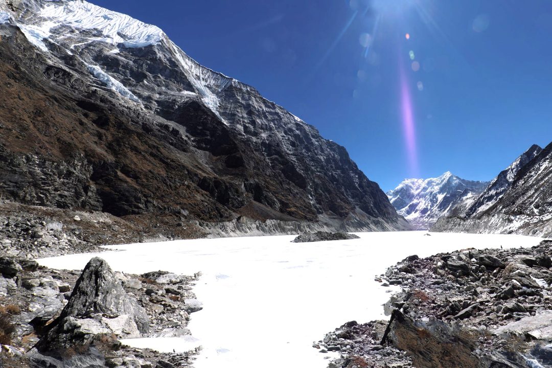
Tsho Rolpa Lake is the largest glacial lake in Nepal. It sits high in the remote Rolwaling Valley, far from the busy trekking trails. The turquoise water reflects giant peaks like Gaurishankar and Melungtse.
Very few trekkers know this place exists. The trail stays quiet, wild, and deeply peaceful. You walk through Sherpa villages, pine forests, and glacier moraines to reach the shore.
This guide covers everything about Tsho Rolpa Lake. You will learn its altitude, location, distance, and trail details. There is also information on permits, cost, weather, and safety.
Every detail here comes from real trekking sources. No filler. Just clear facts for real travelers.
Table of Contents
Tsho Rolpa Lake at a Glance
| Detail | Information |
|---|---|
| Name | Tsho Rolpa (also Chho Rolpa) |
| Meaning | “Tsho” means lake, “Rolpa” refers to Rolwaling Valley |
| Type | Glacial lake |
| Altitude | About 4,580 m (15,030 ft) |
| Location | Rolwaling Valley, Dolakha District, Nepal |
| Coordinates | 27°52′N, 86°28′E |
| Size | About 3.4 km long, 0.5 km wide |
| Status | Largest glacial lake in Nepal |
| Nearest village | Na (4,180 m) |
| Protected area | Gaurishankar Conservation Area |
| Permit needed | GCAP permit |
| Best season | March to May, October to November |
| Difficulty | Moderate to challenging |
| Trek length | 7 to 10 days |
Where Is Tsho Rolpa Lake Located?
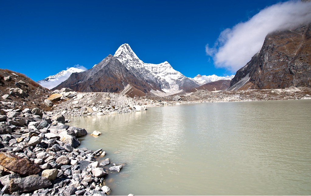
Tsho Rolpa Lake lies in the Rolwaling Valley, inside Dolakha District. This region sits in east-central Nepal, between Langtang and Everest. Few outsiders ever pass through this valley.
The lake sits below the Trakarding Glacier, deep in the Gaurishankar Conservation Area. This protected zone borders Tibet to the north. Local Sherpa families have lived here for generations.
The nearest big town is Charikot, the district headquarters of Dolakha. From Charikot, rough roads lead further into the mountains. Kathmandu remains the main starting point for most travelers.
Distance from major places
| From | Approximate distance | Travel time |
|---|---|---|
| Kathmandu to Singati | 150 km | 7 to 9 hours by bus or jeep |
| Singati to Chhetchhet | 10 km | 45 minutes by jeep |
| Chhetchhet to Simigaon | 5 km | 2 to 3 hours on foot |
| Simigaon to Na village | 30 km | 4 to 5 days walking |
| Na village to Tsho Rolpa | 6 km | 3 to 4 hours one way |
Roads in this region are rough and often damaged by landslides. Always keep extra travel days in your plan.
Tsho Rolpa Lake Altitude Explained
Tsho Rolpa Lake sits at roughly 4,580 meters above sea level. Some sources list it slightly lower, around 4,540 meters. Small gaps like this are normal for remote Himalayan lakes.
This altitude is serious. It sits higher than Everest Base Camp’s Gorak Shep village. Oxygen levels here are far lower than at sea level.
Why the altitude matters here
At 4,580 meters, the air holds about 58 percent of sea-level oxygen. Walking feels harder. Breathing becomes heavier, even on flat ground.
This trek is not for rushed schedules. Your body needs days to adjust slowly. Skipping this step raises your risk of altitude sickness.
Take the acclimatization days seriously. Beding and Na village both work well for rest stops. Do not push straight to the lake without pausing first.
The glacier behind the lake
Tsho Rolpa formed from the Trakarding Glacier, which flows down from the Rolwaling Himal. Melting ice built up behind a natural moraine wall. Over time, this trapped water grew into a massive lake.
Fifty years ago, this lake barely existed as a small pond. Warming temperatures have expanded it many times over. Today it stretches over three kilometers long.
A lake being watched closely
Tsho Rolpa poses real flood risk to villages downstream. Scientists call this danger a glacial lake outburst flood, or GLOF. Over six thousand people live in the flood path below.
Engineers installed an early warning siren system in the 1990s. It later stopped working due to lack of upkeep. Newer systems have since replaced the old equipment.
This is not a reason to fear visiting. It simply shows why this lake matters to researchers. Your permit fees help fund monitoring and conservation work here.
Why Visit Tsho Rolpa Lake?
Nepal has many glacial lakes, but Tsho Rolpa stands apart for clear reasons.
- True remoteness: Very few trekkers walk this trail each year. You get silence, space, and untouched mountain views.
- Record size: This is officially the largest glacial lake in the country. Its scale genuinely surprises first-time visitors.
- Mountain backdrop: Gaurishankar, Melungtse, and other giants tower above the water. Their reflections shimmer across the surface on calm days.
- Untouched culture: Sherpa villages here feel older and quieter than busier regions. Locals welcome visitors warmly and without the usual crowds.
- Good value: Costs stay lower here than on popular circuits. You get big mountains without the high trekking price tag.
- Wild trail: Forests, rivers, and glacier moraines fill this journey. Every day brings a fresh kind of scenery.
These reasons make Tsho Rolpa a hidden reward for patient trekkers.
How to Reach Tsho Rolpa Lake
Reaching this lake takes real effort, but the route stays simple to follow.
Option 1: Bus or jeep from Kathmandu to Singati
Most trekkers start with a long drive from Kathmandu. Buses leave early, usually around 6:30 in the morning. The ride takes seven to nine hours, depending on road conditions.
From Singati, a short jeep ride reaches Chhetchhet. This saves about an hour of extra walking. Rough roads here often depend heavily on the season.
Option 2: Private jeep the whole way
Hiring a private jeep costs more but saves time and stress. You travel straight from Kathmandu to Chhetchhet or Gongar Khola. This suits travelers with limited days available.
Expect a bumpy ride through mountain roads. Landslides sometimes block the path during monsoon months. Always keep a flexible backup plan ready.
Option 3: Combine with Rolwaling Valley circuit
Some trekkers extend their trip toward Tashi Lapsa Pass. This connects Rolwaling with the Everest region trails. This route needs a guide, camping gear, and strong experience.
This option suits only serious, well-prepared mountain trekkers. It is not recommended for beginners or casual hikers.
Tsho Rolpa Trek: Full Itinerary Breakdown
Here is a full, realistic plan most trekking companies follow.
Day 1: Drive from Kathmandu to Chhetchhet or Gongar Khola (1,430 m).
Day 2: Trek from Chhetchhet to Simigaon (2,000 m), 2 to 3 hours.
Day 3: Trek from Simigaon to Dongang (2,791 m), 6 to 7 hours.
Day 4: Trek from Dongang to Beding (3,690 m), 5 to 6 hours.
Day 5: Acclimatization day in Beding. Explore the old monastery nearby.
Day 6: Trek from Beding to Na village (4,180 m), 2 to 3 hours.
Day 7: Hike from Na to Tsho Rolpa Lake and back, 6 to 7 hours.
Day 8: Trek back from Na to Dongang, 6 hours.
Day 9: Trek from Dongang to Simigaon or Chhetchhet, 6 to 7 hours.
Day 10: Drive back from Chhetchhet to Kathmandu.
Some companies shorten this to 7 or 8 days by combining walking stages. Others add a day trip toward Yalung Ri Base Camp near Na. Always match the pace with your fitness and time available.
Best Time to Visit Tsho Rolpa Lake
Season changes everything about this trek. Here is a clear month-by-month picture.
Spring: March to May
Spring brings clear mornings and blooming rhododendron forests along lower trails. Daytime temperatures stay mild, though nights remain cold at altitude. This season ranks among the two best times to go.
Summer and Monsoon: June to August
Rain falls heavily during these months across the whole valley. River crossings become dangerous, and trails turn muddy and slippery. Local teahouse owners often warn against trekking during peak monsoon weeks.
Autumn: September to November
Autumn offers the clearest skies of the entire year. Mountain views stay sharp, and temperatures feel comfortable during daytime walks. This is widely considered the best overall season for this trek.
Winter: December to February
Winter turns this valley bitterly cold and often snow-covered. Many teahouses close, and locals move down to warmer areas. Only experienced, well-equipped trekkers should attempt winter travel here.
Altitude Safety on the Tsho Rolpa Trek
This section matters for every single trekker heading toward Na and the lake.
Understanding Acute Mountain Sickness (AMS)
AMS happens when your body cannot adjust fast enough to thin air. It can start above 2,500 meters. Since this trek reaches 4,580 meters, real caution is necessary.
Common early symptoms
- Headache that will not go away
- Loss of appetite
- Nausea or upset stomach
- Trouble sleeping
- Constant tiredness
- Dizziness while walking
Mild symptoms often ease with rest, food, and water.
Serious warning signs
- Confusion or strange behavior
- Losing balance while walking
- Feeling breathless even while resting
- A wet, bubbling cough
- Severe headache that keeps worsening
These signs demand immediate descent and medical help.
Simple safety rules
- Walk slowly above 3,000 meters.
- Never rush your sleeping altitude upward.
- Climb high during the day, sleep lower at night.
- Drink plenty of water throughout each day.
- Skip alcohol completely at high altitude.
- Eat full, regular meals along the trail.
- Never leave a sick trekker alone.
- Descend right away if symptoms grow worse.
Insurance matters here
Buy travel insurance that covers trekking above 4,500 meters. Confirm it includes helicopter rescue coverage. This trail sits far from any hospital or clinic.
Permits and Rules for Tsho Rolpa Lake
You need one main permit to enter this region legally.
Gaurishankar Conservation Area Permit (GCAP)
This permit costs around NPR 3,000 for foreign trekkers. It funds conservation work and local community projects nearby. You can buy this permit at the Nepal Tourism Board office in Kathmandu.
A TIMS card is not currently required for this specific trek. Rules can change, so always confirm before you travel. Carry your permit at all times along the trail.
Guide and porter requirement
While having a guide is not mandatory for this trip, we highly recommend traveling with a licensed and experienced guide, particularly because this route is remote. Unlike the more commercialized Annapurna Circuit trek and Everest Base Camp Trek, this trail poses unique challenges. Some sections require local knowledge for navigating river crossings and changes in the trail. Many trekking agencies offer a guide as part of their standard packages.
Hiring a local porter also supports the village economy directly. It reduces your load across steep, tiring mountain sections.
Cost of a Tsho Rolpa Lake Trip
Budgets vary, but here is a realistic estimate for planning.
| Item | Cost per person |
|---|---|
| GCAP permit | NPR 3,000 ( approx $ 19.59 ) |
| Bus, Kathmandu to Singati | NPR 800 to NPR 1,000 ( approx $5.22 – $6.52 ) |
| Sharing Jeep, Singati to Chhetchhet | NPR 350 to 550 ( approx $2.29 to $3.59 ) |
| Teahouse room per night | NPR 1000 to 1500 ( approx $6.53 to $9.80 ) |
| Meals per day | NPR 3,300 to 4,000 ( $21.55 to $26.12 ) |
| Guide per day | NPR 4500 to 5500 ( $30 to $35 ) |
| Porter per day | NPR 3000 to 4000 ( $ 20 to $25 ) |
| Travel insurance | $ 100 to 150 ( depending upon the age ) |
- Independent trip cost: USD 400 – USD 550
- Guide trip cost: USD 900 – USD 1150 per person
The actual trip cost may vary depending on the season, group size, transportation arrangements, accommodation, services included, and level of personalized service. When you book a Tsho Rolpa Lake package through a trekking agency in Nepal, the final price will depend on the services included in the package. For an exact quotation, please contact us directly.
What to Pack for the Tsho Rolpa Trek
Packing right matters more here than on easier, shorter trails.
Clothing
- Base layers, wool or synthetic
- Warm fleece or light down jacket
- Waterproof, windproof outer shell
- Trekking trousers
- Warm hat and sun hat
- Insulated gloves
- Thick trekking socks
Footwear
- Sturdy, broken-in trekking boots
- Light shoes for evenings at the lodge
Essentials
- UV-protective sunglasses
- Strong sunscreen
- SPF lip balm
- Reusable water bottle
- Water purification tablets or filter
- Headlamp with spare batteries
- Portable power bank
- Small first aid kit
- Any personal medication
Nice to have
- Trekking poles for steep sections
- Camera with a wide lens
- Compact binoculars
- Extra snacks from Kathmandu
Electricity and WiFi barely exist beyond Simigaon. Bring cash, since cards do not work here. Waste facilities remain very limited, so pack out everything you bring in.
Where to Stay and Eat Along the Trail
Teahouses here feel simple, warm, and family-run.
Accommodation
Rooms are basic, with shared bathrooms in most villages. Expect thin walls and cold nights above Beding. Prices stay low compared to busier trekking regions.
Food
Dal bhat remains the main meal across the entire trail. Rice, lentils, and vegetables come with unlimited refills. Meat becomes rare, and even forbidden, past Kyalche village.
Eggs and simple noodle dishes are also common lower down. Higher villages offer fewer food choices as supplies grow scarce.
Practical tips
- Carry enough Nepali cash for the full trip.
- Order breakfast the night before an early departure.
- Avoid meat dishes at high altitude for safety reasons.
- Expect no WiFi beyond the lower villages.
- Move slowly and rest often near Na village.
Things to Do Near Tsho Rolpa Lake
The trail offers more than just the final lake view.
Beding Monastery
Beding is the largest Sherpa village in this whole valley. An old monastery sits near the village entrance. Locals consider this a spiritually important stop.
Na Village
Na sits close to the lake, at 4,180 meters altitude. It works well as a rest and acclimatization stop. Simple lodges here offer basic but welcoming service.
Yalung Ri Base Camp
Adventurous trekkers can extend their trip toward this base camp. It sits near 5,100 meters, above Na village. This adds a full extra day to your itinerary.
Rolwaling Glacier
Trekkers walk directly across parts of this glacier’s moraine. It leads straight toward the shore of Tsho Rolpa. The scenery here feels raw and dramatic.
Cantilever Bridge
A well-known cantilever bridge crosses a river along this route. Swiss engineers helped build many trail improvements here decades ago. It remains a memorable stop for photographs.
Culture and People of Rolwaling Valley
This valley holds deep meaning within Sherpa tradition and folklore.
Local Sherpa clans have lived here for many generations. Their customs connect closely to Tibetan Buddhist practice. Prayer flags, mani walls, and small gompas line the trail.
Legend describes Rolwaling as one of Nepal’s seven hidden valleys. Some stories even connect this region to the mythical yeti. Locals still speak about these tales with quiet pride.
Simple etiquette to follow
- Walk clockwise around mani walls and chortens.
- Ask permission before photographing local people.
- Remove your shoes before entering monasteries.
- Dress modestly while passing through villages.
- Avoid touching religious objects or statues.
- Give donations quietly, without drawing attention.
Respectful behavior earns warm hospitality in return.
Photography Tips for Tsho Rolpa Lake
This remote lake rewards patient, careful photographers.
- Shoot at sunrise. Morning light stays soft, and wind stays calm.
- Use a polarizing filter. It deepens the turquoise water color.
- Add a person for scale. The lake’s true size is easy to miss otherwise.
- Capture the peaks behind it. Gaurishankar and Melungtse frame the whole scene.
- Protect your batteries. Cold temperatures drain power much faster than usual.
- Watch your footing. Moraine rock stays loose and uneven near the shore.
Responsible Travel at Tsho Rolpa Lake
This landscape stays fragile, and small choices matter here.
Waste
Carry out everything you bring, including wrappers and batteries. Avoid single-use plastic bottles wherever possible. Use purification tablets or a filter instead.
Water
Never wash clothes or dishes directly in the lake. Use designated teahouse facilities for all washing needs.
Wildlife
This region hosts rare birds and alpine wildlife nearby. Observe animals quietly from a respectful distance. Never feed wild animals along the trail.
Supporting local communities
Stay in family-run teahouses whenever you can. Hire local guides and porters at fair local rates. Buy simple local goods to support village income directly.
Common Mistakes Trekkers Make
Learning from others helps you avoid these frequent errors.
- Rushing the itinerary. Skipping rest days raises altitude sickness risk sharply.
- Underestimating the cold. Nights near Na and Tsho Rolpa turn brutally cold.
- Ignoring river crossings. Water levels rise fast during monsoon months.
- Packing too little cash. No ATMs or card payments exist here.
- Choosing new boots. Blisters can ruin an otherwise wonderful trek.
- Traveling without a guide. Trail markings can be unclear in remote sections.
- Forgetting insurance. Rescue costs here run extremely high without coverage.
Who Should Visit Tsho Rolpa Lake?
This trek suits a specific kind of traveler best.
- Experienced trekkers: Ideal for those with prior high-altitude trekking experience.
- Adventure seekers: Perfect for travelers wanting silence over crowded trails.
- Fit hikers: Good physical condition helps across steep, remote terrain.
- Photography lovers: Rewarding for anyone chasing untouched mountain scenes.
- Budget travelers: A cheaper alternative to popular, crowded circuit treks.
Beginners should build experience elsewhere before attempting this remote route. Strong preparation always makes this journey safer and more enjoyable.
Frequently Asked Questions
What is the altitude of Tsho Rolpa Lake?
- Tsho Rolpa sits at roughly 4,580 meters, or about 15,030 feet.
Where is Tsho Rolpa Lake located?
- It lies in the Rolwaling Valley, Dolakha District, in east-central Nepal.
How do I reach Tsho Rolpa Lake?
- Travel from Kathmandu to Singati by bus, then trek through Simigaon and Beding toward Na village.
How long is the Tsho Rolpa trek?
- Most itineraries run between 7 and 10 days from Kathmandu and back.
Is the Tsho Rolpa trek difficult?
- Yes, it is considered moderately challenging due to remote trails and high altitude.
Do I need a permit for this trek?
- Yes, the Gaurishankar Conservation Area Permit is required for all foreign trekkers.
How much does the permit cost?
- It costs approximately NPR 3,000, or around USD 25 to 30.
Do I need a guide for this route?
- It is strongly recommended due to remote terrain and limited trail markings.
What formed Tsho Rolpa Lake?
- Melting ice from the Trakarding Glacier collected behind a natural moraine dam.
Is Tsho Rolpa Lake dangerous?
- It carries a known glacial flood risk, monitored closely by Nepali authorities.
What is the best time to visit?
- Spring and autumn offer the clearest skies and safest trail conditions.
Can I see mountains from the lake?
- Yes, Gaurishankar and Melungtse rise dramatically above the water.
Is there mobile signal along the trail?
- Signal becomes patchy or unavailable past the lower villages.
Can beginners attempt this trek?
- It is better suited to trekkers with some prior high-altitude experience.
Is Tsho Rolpa the same as Gokyo or Tilicho Lake?
- No, each lake sits in a different valley with a separate trekking route.
Final Thoughts
Tsho Rolpa Lake rewards trekkers willing to walk away from crowded trails. The journey passes quiet forests, old Sherpa villages, and wide glacier moraines. Reaching the shore feels like a rare, earned privilege.
Respect the altitude, and move at a steady, patient pace. Carry out your waste, and support the small teahouses along the way. This valley remains untouched partly because visitors treat it gently.
Sit by the water, watch the mountains, and listen to the silence. That quiet moment stays with you long after the trek ends.
-
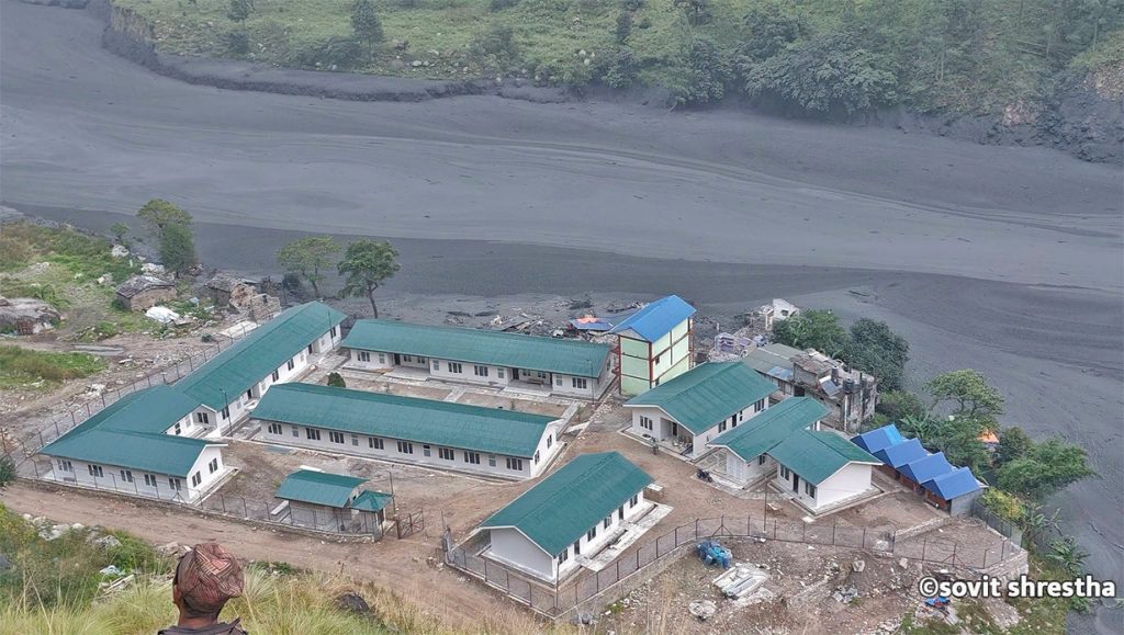
Flash Flood Sweeps Away Dozens of Homes in Gorkha, Nepal
KATHMANDU, Nepal — A sudden and severe flash flood tore through the Budhi Gandaki River basin in Gorkha district on Sunday morning, washing away approximately 35 houses and triggering widespread destruction in the mountainous Manaslu and Tsum Valley regions. According to local authorities and disaster management officials, no human casualties have been reported thus far, though…
-
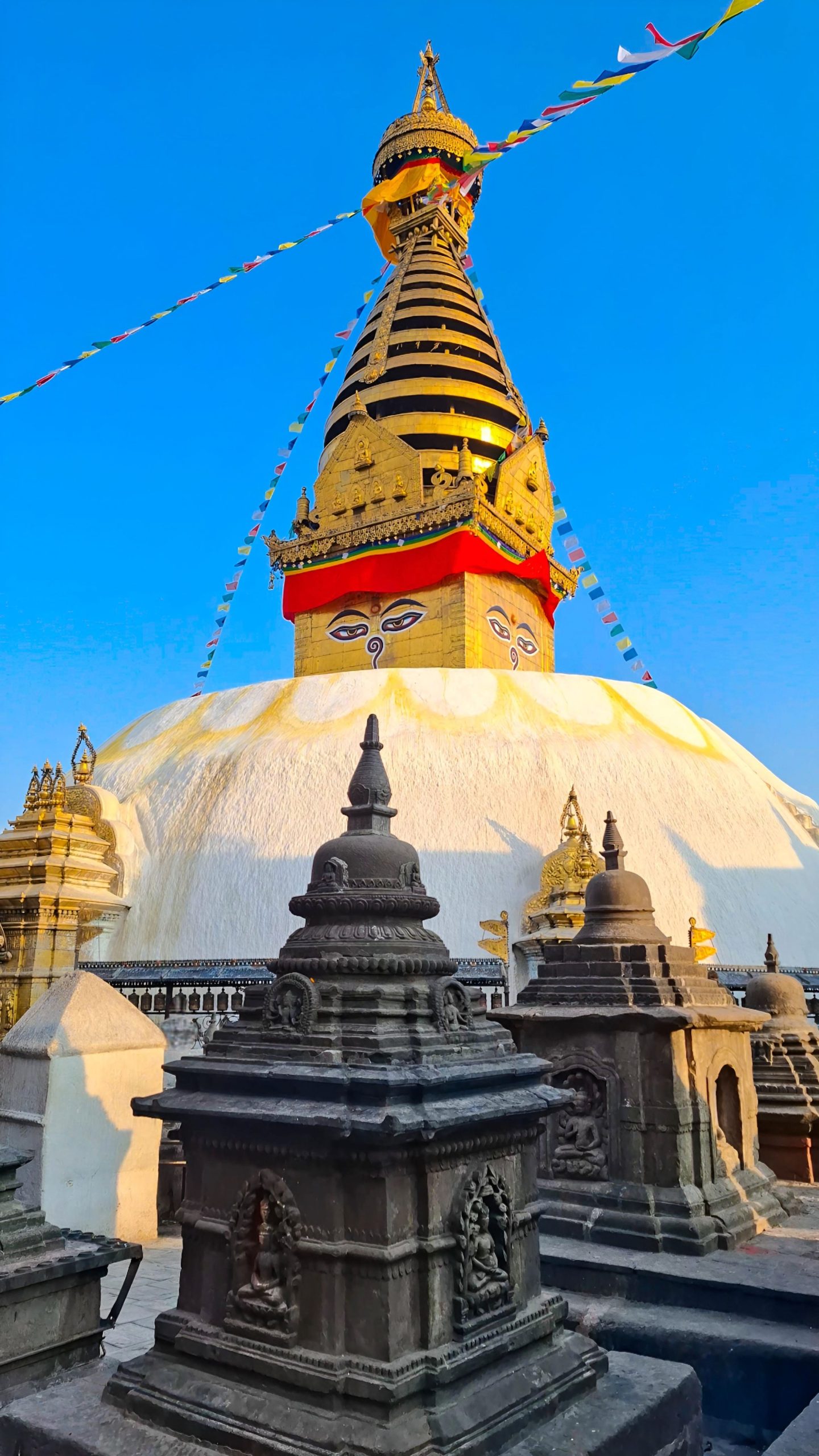
Swayambhunath Temple, Kathmandu
Imagine standing above the chaos of Kathmandu. Honking horns fade below you. A gleaming white dome rises ahead. Two enormous painted eyes gaze calmly in every direction. Prayer flags flutter in the Himalayan breeze. This is Swayambhunath, one of the most extraordinary places in Nepal. Visitors know it as the “Monkey Temple” because hundreds of…
-
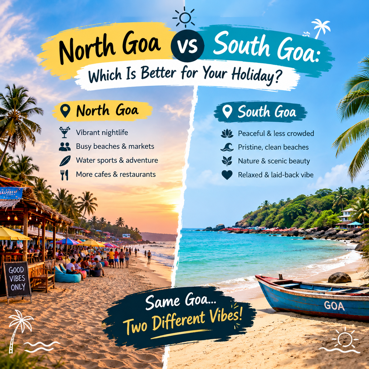
North Goa vs South Goa: Which Is Better for Your Holiday?
Amongst the places that are highly popular in terms of beaches, weather, culture, and ambiance in India is Goa, which is known to possess some of the most beautiful beaches in India. The idea of Goa being famous for its beaches, which can be used by tourists for entertainment in North Goa while South Goa…