
Gorakshep: Altitude, Distance & EBC Hike Guide
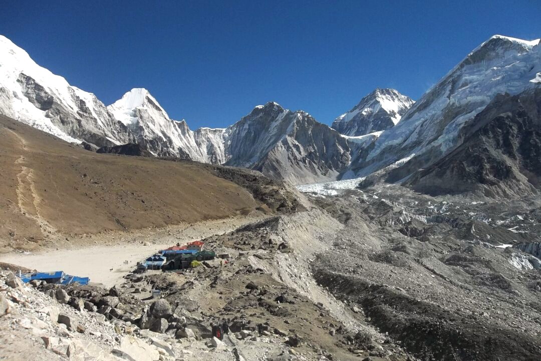
Gorakshep sits at 5,164 meters. That makes it the highest sleeping stop on the whole Everest Base Camp trek. It rests on a flat, sandy, dry lake bed. Big mountains surround it on every side.
The name Gorak Shep comes from the Tibetan language and is commonly translated as “dead ravens” or “dead crows,” referring to the barren landscape where very little wildlife can survive.
Gorakshep (5,164 m / 16,942 ft) is the highest overnight stop on the Everest Base Camp Trek and the last settlement before Everest Base Camp. Surrounded by glaciers and towering Himalayan peaks, it serves as the gateway to both Everest Base Camp and Kala Patthar.
This small settlement was the original Everest Base Camp until the 1970s. Sir Edmund Hillary and Tenzing Norgay used this same ground before their first summit in 1953. Later, the base camp moved further east to its current spot.
Today, only 3 to 4 small teahouses stand here. They serve trekkers heading to Everest Base Camp or Kala Patthar. No one lives here all year round, since winters are far too harsh.
Table of Contents
Altitude and Location
The village is located at an altitude of 5,164 meters (16,942 ft), where oxygen levels are approximately half of those at sea level. Most trekkers experience shortness of breath in this location.
It lies in the Khumbu region of the Solukhumbu district. Lobuche sits below it to the south. Everest Base Camp and Kala Patthar sit above it, further north and east.
Mount Pumori (7,161 m) towers directly behind the settlement, while Nuptse and Changtse rise nearby. The famous Khumbu Glacier flows just past the village edge.

Distance and Walking Time
Here is real distance data for planning your trek day by day.
| Route | Approximate Distance | Average Walking Time |
| Lukla → Gorakshep | 60–65 km | 8–9 days |
| Lobuche → Gorakshep | 4–5 km | 3–4 hours |
| Gorakshep → Everest Base Camp | 3.5 km (one way) | 2–3 hours |
| Gorakshep → Kala Patthar | 1.5 km (one way) | 1.5–2 hours |
The trail from Lobuche follows the Khumbu Glacier moraine. Be prepared for loose rocks, boulders, and uneven terrain throughout the entire route.
Gorakshep Weather and Best Time to Visit
Gorakshep can be visited most of the year. Only the monsoon months, mid-June to August, are best avoided due to rain and clouds.
- Spring (March–May): Long, sunny days with clear morning views. Afternoons often turn cloudy and windy. Nights stay freezing cold.
- Autumn (September–November): The clearest skies of the year. Days are shorter and cold. Mornings and nights often drop below freezing.
- Winter (December–February): Very few trekkers on the trail. Days are short and freezing. Some lodges at Lobuche and Gorakshep may close.
Wind-chill adds extra cold at this height. Always pack warm layers, even in spring and autumn.
Related: Best season to visit Everest Base Camp
Gorakshep Lodges and Where to Stay
Accommodation here is limited to three or four basic teahouses, including Buddha Lodge, Snowland Inn, and Peak XV Hotel. Rooms are basic, small, and unheated.
All lodges share one thing: no attached bathrooms. Pipes freeze fast at this altitude, so toilets and showers stay shared and outside the rooms.
Each lodge has one warm dining hall. A yak-dung stove heats the whole room in the evening. Solar power runs the lights and charging points.
Do not expect luxury here. Rooms are simple, but food menus offer soup, noodles, rice, and hot tea. This keeps trekkers fed and warm before the big hike ahead.
Electricity is supplied by solar power, so charging electronic devices usually costs an extra fee. Wi-Fi is limited and often unreliable due to the remote location. Despite the basic facilities, the teahouses provide warm meals and a comfortable place to rest before hiking to Everest Base Camp or Kala Patthar.
Nearby Attractions
The village serves as the starting point for several iconic attractions in the Everest region.
- Khumbu Glacier: Nepal’s longest glacier, flowing right past the village.
- Khumbu Icefall: A dangerous, dramatic ice section seen from Base Camp.
- Mount Pumori (7,161 m): Towers directly behind the village.
- Mount Nuptse (7,861 m): Visible on the walk to Base Camp.
- Changtse Peak (7,553 m): Sits north, close to the Tibet border.
- Everest Base Camp (5,364 m): The main goal for most trekkers.
- Kala Patthar (5,545 m): The best sunrise viewpoint of Mount Everest.
Acclimatization Tips at Gorakshep
At 5,164 m, altitude sickness is common. Your body needs extra care at this height, since oxygen levels drop fast. Follow these simple steps to stay safe.
Signs of Altitude Sickness
- Headache that does not go away with rest
- Nausea or loss of appetite
- Dizziness or trouble sleeping
- Shortness of breath, even at rest
- Unusual tiredness or weakness
How to Acclimatize Safely
- Drink water: Aim for 3–4 liters daily to help your body adjust.
- Avoid alcohol: It worsens dehydration and hides symptoms.
- Walk slowly: Keep a steady, relaxed pace, especially above 4,000 m.
- Rest at Lobuche: Spend an extra night here if you feel unwell before Gorakshep.
- Eat light, warm meals: Soup and carbs digest easier at high altitude.
- Sleep low, climb high: Do short walks to higher points, then return to sleep lower when possible.
When to Descend
If symptoms worsen, descend immediately and seek medical assistance. Never push higher with a bad headache, vomiting, or confusion. A guide or lodge owner can help arrange help fast if needed.
Gorakshep to Kala Patthar Hike
| Gorakshep to Kala Patthar Hike | Information |
| One-Way Distance | 1.6 km / 1 mile |
| Elevation Gain | 381 m / 1,250 ft |
| Ascent Time | 1.5 to 2 hours |
| Descent Time | 45 minutes to 1 hour |
| Round-Trip Duration | About 2.5 to 3 hours |
| Best Start Time | 4:00 to 4:30 AM (for sunrise) |
| Trail Type | Steep, rocky, and loose scree trail |
| Difficulty Level | Moderate to Challenging |
| Main Highlights | Sunrise over Mount Everest, 360° Himalayan panorama, views of the Khumbu Glacier and surrounding peaks |
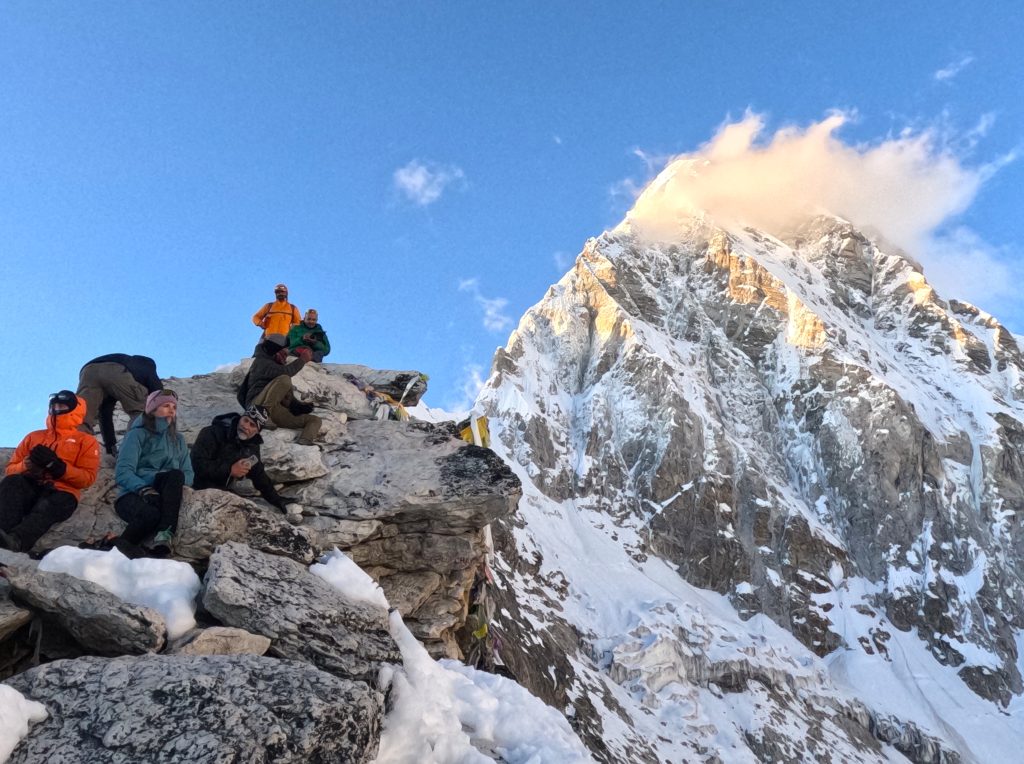
Most trekkers climb Kala Patthar early in the morning. This timing gives clear skies and a bright sunrise over Everest.
There are two rocky tops. The lower point sits at 5,545 meters. This is where most trekkers stop for photos and views.
The first 30 minutes cross flat, sandy ground out of Gorakshep. After that, the trail turns steep fast. Loose black rock and scree make footing tricky.
The final push to the viewpoint takes about 30 to 40 minutes of hard climbing. Expect your heart rate and breathing to rise fast here.
Going down takes far less time than going up, usually 45 minutes to 1 hour. Trekking poles help a lot on the way back.
Temperatures at the top often sit between -10°C and -20°C before sunrise. From the top, you can see Mount Everest, Lhotse, and Nuptse up close. Ama Dablam and Cho Oyu also appear on a clear day.
Gorakshep to Everest Base Camp Hike

| Gorakshep to Everest Base Camp Hike | Information |
| One-way distance | 6 km / 3.7 miles |
| Elevation gain | 200 m / 656 ft |
| Ascent time | 3–4 hours |
| Descent time | 2–3 hours |
| Round-trip time | About 6–7 hours |
| Best start time | 6:00–7:00 AM |
| Trail type | Rocky moraine, boulders, glacier edge |
The first 2 km stay fairly flat and easy, taking about 45 minutes to 1 hour. The middle 2 to 3 km cross the Khumbu Glacier moraine – boulders, ice ridges, and small ponds – taking 1.5 to 2 hours. The final 1 km climbs gently to the Base Camp marker, taking 30 to 45 minutes.
You will see the Khumbu Icefall up close, along with Nuptse and Changtse peaks. Mount Everest itself stays hidden from this spot.
Most trekkers return to Gorakshep in under 3 hours. Total round-trip time, with rest stops, runs close to 6–7 hours.
FAQ: Frequently Asked Questions(FAQs)
1. What is the altitude of Gorakshep?
- Gorakshep sits at 5,164 meters, or 16,942 feet. It is the highest overnight stop on the Everest Base Camp trek.
2. How far is Gorakshep from Everest Base Camp?
- Gorakshep is about 6 km from Everest Base Camp. The walk takes 3 to 4 hours one way.
3. How do I get to Gorakshep?
- Fly from Kathmandu to Lukla first. Then trek through Phakding, Namche Bazaar, Tengboche, Dingboche, and Lobuche before reaching Gorakshep.
4. Is there any vegetation in Gorakshep?
- No. Trees and bushes stop near Tengboche. From Thukla onward, the land turns barren, rocky, and dry all the way to Gorakshep.
5. Can I find luxury hotels in Gorakshep?
- No. Luxury lodges exist only up to Lobuche. Gorakshep offers only basic rooms with shared bathrooms.
6. How high is Kala Patthar compared to Gorakshep?
- Kala Patthar stands at 5,545 meters. That is about 381 meters higher than Gorakshep village.
7. What is the best time to visit Gorakshep?
- Spring (March–May) and autumn (September–November) offer the clearest skies and safest trails.
8. Why is it called Gorakshep?
- The name means “dead ravens” in Tibetan language. It likely comes from dead birds once found in this harsh, high-altitude spot.
9. Was Gorakshep the original Everest Base Camp?
- Yes. Gorakshep served as the real Everest Base Camp until the 1970s, including during the first successful summit in 1953.
10. Is Gorakshep safe for altitude sickness?
- Altitude sickness risk is high at 5,164 meters. Drink plenty of water, walk slowly, and rest an extra night at Lobuche if needed.
11. Can helicopters land at Gorakshep?
- Yes. Helicopters often land near Gorakshep for scenic flights and emergency rescues. Many trekkers also use them for a quick return to Lukla.
12. Is Wi-Fi available at Gorakshep?
- Yes, but it is slow and costs extra. Most lodges sell Wi-Fi cards, though connection often drops due to weather and altitude.
13. Can beginners reach Gorakshep?
- Yes, with good preparation. Beginners should train before the trek, walk slowly, and add extra acclimatization days at Namche Bazaar and Dingboche.
Final Say
This tiny village is more than just a place to sleep. It marks the edge of the map, where trees, roads, and comfort all disappear. Every trekker who reaches this point has already earned the final push ahead.
The hard climb to Kala Patthar rewards you with the best sunrise view of Everest on the whole route. The walk out to Base Camp puts you face to face with the Khumbu Icefall and the mountain’s true scale. Both hikes are tough, but neither takes more than a day.
Plan for cold nights, thin air, and simple food here. Move slowly, drink enough water, and give your body time to adjust. Do this, and the final steps of your Everest journey will feel earned, not just endured.
Whether your goal is to stand at Everest Base Camp or watch the sunrise from Kala Patthar, Gorakshep is the final gateway to both. Although the altitude, freezing temperatures, and basic facilities make it one of the most challenging overnight stops in Nepal, the unforgettable Himalayan scenery makes every step worthwhile. Prepare well, acclimatize properly, and this remarkable settlement will become one of the highlights of your Everest adventure.
-
Flash Flood Sweeps Away Dozens of Homes in Gorkha, Nepal
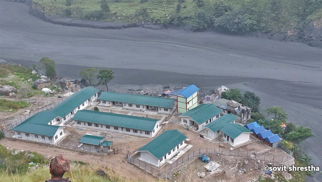
KATHMANDU, Nepal — A sudden and severe flash flood tore through the Budhi Gandaki River basin in Gorkha district on Sunday morning, washing away approximately 35 houses and triggering widespread destruction in the mountainous Manaslu and Tsum Valley regions. According to local authorities and disaster management officials, no human casualties have been reported thus far, though…
-
Swayambhunath Temple, Kathmandu
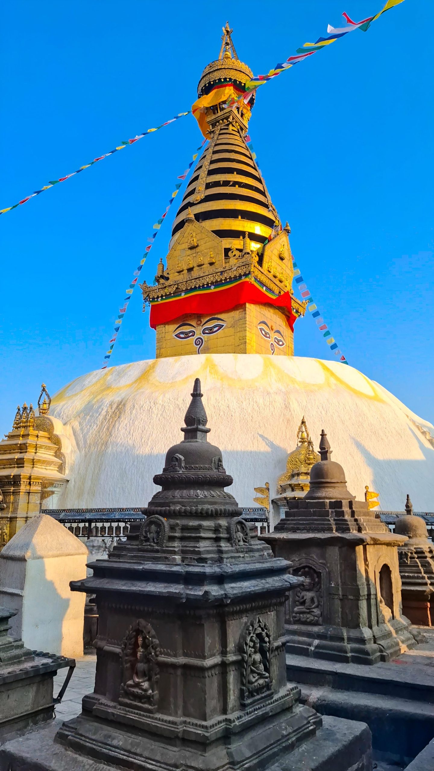
Imagine standing above the chaos of Kathmandu. Honking horns fade below you. A gleaming white dome rises ahead. Two enormous painted eyes gaze calmly in every direction. Prayer flags flutter in the Himalayan breeze. This is Swayambhunath, one of the most extraordinary places in Nepal. Visitors know it as the “Monkey Temple” because hundreds of…
-

North Goa vs South Goa: Which Is Better for Your Holiday?
Amongst the places that are highly popular in terms of beaches, weather, culture, and ambiance in India is Goa, which is known to possess some of the most beautiful beaches in India. The idea of Goa being famous for its beaches, which can be used by tourists for entertainment in North Goa while South Goa…