
Where Is Nepal Located? Nepal on the Map, Asia and Geography
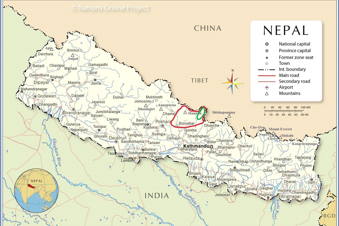
Where Is Nepal Located? We get this question a lot, usually right before someone books a trip with us. So where exactly is Nepal? It sits in South Asia, wedged into the Himalayan mountain range, home to the tallest peaks on the planet.
At High Route Adventure, we have spent years guiding trekkers across this country. We have hiked through its lowland jungles and crossed its icy mountain passes more times than we can count. In this guide, we will walk you through Nepal’s location and geography. We will also cover why it pulls in so many travelers.
Maybe you are planning your first trip. Maybe you just stumbled on Nepal while scrolling a map. Either way, this article should answer whatever you are wondering.
Nepal is not a big country. Yet it holds some of the biggest names in world geography. Mount Everest, the Annapurna range, and the Kathmandu Valley all sit within its borders. Once you understand where Nepal sits, it becomes obvious why hikers, climbers, and curious travelers keep coming back.
Table of Contents
Where Is Nepal Located in Asia?
Nepal sits in South Asia. More specifically, it lies in the Himalayan region, right where two of the world’s biggest countries meet.
India lies to the south, east, and west. China sits to the north, across the Tibetan Plateau. That is the short version.
This puts Nepal on the Indian subcontinent, though its northern edge climbs straight into the high Himalayas. Honestly, not many countries squeeze this much variety into such a small footprint.
Nepal’s location on the map tends to surprise first-time visitors. People expect something small and flat. What they find instead is a country that rises from steamy plains to the tallest peaks on Earth. All within a few hundred kilometers.
The northern border sits high, often above 5,000 meters. The southern border, down in the Terai plains, barely clears a few hundred meters. That is one of the steepest elevation changes anywhere in the world.
Because of this, people often describe Nepal as a bridge. It connects the flat plains of northern India with the high Tibetan plateau. Fly into Kathmandu, and you will feel this shift almost immediately. Warm air gives way to sharp mountain wind within hours.
Where Is Nepal on the World Map?
Pull up a world map, and Nepal shows up as a thin, rectangular strip in South Asia. It sits just south of Tibet and just north of the Ganges plain in India.
On an Asia map, Nepal sits roughly in the Middle of the continent’s southern belt. Its two neighbors dwarf it in size.
Nepal’s position relative to India and China shapes a lot: its climate, its culture, its history. The country works almost like a hinge between the Indian lowlands and the Tibetan highlands.
People searching for Nepal on the map usually want to know one thing. How close is it to everything else? Turns out, pretty close. Mount Everest, Lhasa, and Delhi are all within a day or two of Kathmandu.
Kathmandu itself acts as the country’s main gateway. Nearly every international flight lands there first. From the capital, Pokhara sits about 200 kilometers west, while the Everest region lies roughly 140 kilometers to the northeast.
This central layout makes exploring Nepal easier than the rugged terrain might suggest. Short domestic flights and winding mountain roads connect Kathmandu to nearly every major trekking region.
Which Countries Border Nepal?
Only two countries border Nepal, but both happen to be enormous.
India borders Nepal along the south, east, and west, stretching over 1,800 kilometers. Several open crossings let people move freely between the two nations.
China, through Tibet, borders Nepal to the north. This border traces the crest of the Himalayas, making it one of the highest international borders anywhere.
Sitting between these two giants has shaped Nepal’s trade, culture, and politics for centuries. Trekkers crossing high mountain passes sometimes catch a glimpse of the Tibetan border. It is a small reminder of how close things are up there.
The open border with India keeps travel simple. Many Indian citizens cross without needing a visa, and goods flow freely through several official points. This relationship has left its mark on Nepal’s food, language, and everyday life.
The China border tells a different story. It runs through remote, high-altitude terrain, and only a handful of crossings exist. Traffic here stays light, but the border still matters for trade and for Buddhist pilgrims heading toward Tibet.
Is Nepal in India?
No, and this trips people up more often than you would think. Nepal is its own country, fully independent, sitting in South Asia.
Nepal has its own flag, its own constitution, its own government. It joined the United Nations back in 1955 as an independent member. Its laws and borders are entirely separate from India, even with all the cultural overlap.
Some travelers also mix Nepal up with Tibet, since both share Buddhist traditions and mountain culture. Tibet is an autonomous region inside China. Nepal is not. Worth keeping straight before you land.
So if you were wondering, is Nepal part of India, now you know. It is not. Nepal stands entirely on its own.
What Continent Is Nepal In?
Nepal sits in Asia, and more precisely, in South Asia.
Nepal’s country location falls fully within Asia. No territory sits anywhere else. Simple as that.
Asia covers a massive range of climates and cultures. It stretches from desert regions in the west to tropical islands in the southeast. Nepal represents the mountainous, Himalayan side of all that. It sits a world away from Middle Eastern deserts and tropical eastern islands.
Within South Asia, Nepal shares the neighborhood with India, Bhutan, Bangladesh, Pakistan, and Sri Lanka. What sets Nepal apart is its extreme elevation range. It also holds so many of the world’s highest peaks.
Nepal’s Geographic Coordinates and Size
For the number lovers among you, here are the specifics.
Nepal’s latitude runs from about 26°22′N to 30°27′N. Longitude runs from about 80°04′E to 88°12′E. That places the whole country in the northern hemisphere, within the tropical and subtropical belt of Asia.
Total area comes to roughly 147,181 square kilometers. That is a bit larger than Bangladesh, but nowhere close to its two neighbors.
Nepal even keeps its own time zone, Nepal Standard Time, set at UTC plus 5 hours and 45 minutes. That odd 45-minute offset throws off almost every first-time visitor. Most countries stick to the hour or half-hour mark.
And here is a fact that still surprises people: Nepal holds eight of the world’s fourteen peaks above 8,000 meters. No other country comes close. That single detail explains a lot about why climbers treat this place like a bucket list destination.
Nepal’s Diverse Geography
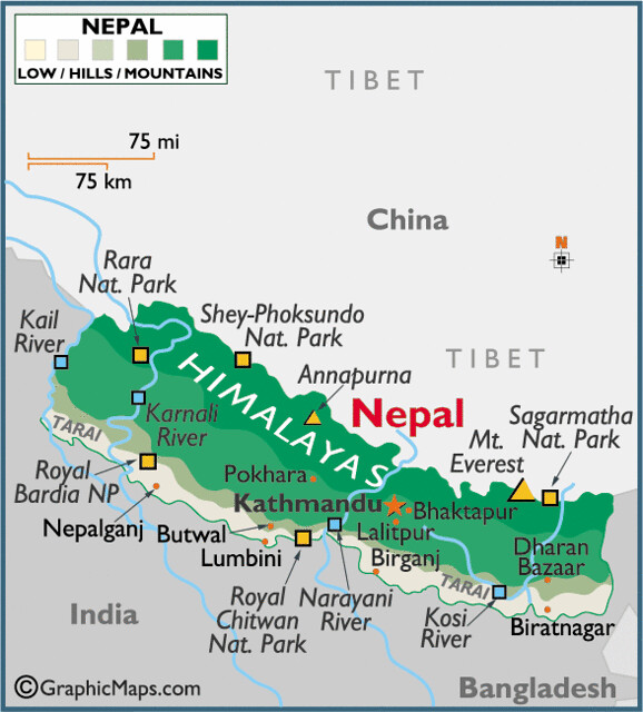
Few countries pack in this much variety. Within a few hundred kilometers, the land climbs from steamy jungle plains to frozen mountain summits. Nepal breaks down into three main regions.
1. Mountain Region
The Mountain Region covers the north and holds the Himalayas, the highest range on Earth.
This is where Mount Everest sits, topping out at 8,849 meters. Several other eight-thousand-meter giants live here too, including Annapurna, Manaslu, and Kanchenjunga.
Glaciers wind through the high valleys, feeding rivers that support millions of people further downstream. Trekkers and climbers flock here for the same reason we do; the scenery simply does not exist anywhere else.
Life up here is tough, but the people who call it home have adapted over centuries. Sherpa communities have lived among these peaks for generations, thriving in thin air and brutal cold.
Villages often sit above 3,000 meters, higher than most towns anywhere else on Earth. Stone houses, prayer flags, and small monasteries dot the trail. You can feel the Tibetan Buddhist influence in nearly everything.
Trekking through this region takes real preparation. The air thins out fast, and weather can flip within hours. Even so, thousands of people cross it safely each year. Experienced local guides who know these mountains make that possible.
2. Hill Region
South of the mountains sits the Hill Region, covering central Nepal.
This is where you find the Kathmandu Valley. It holds the capital and a huge chunk of the country’s cultural history. Pokhara Valley sits here too, known for its lakes and postcard views of the Annapurna range.
Rolling hills, terraced farms, and green valleys define this middle zone. Most Nepalis live here, in a climate that stays milder than the mountains but cooler than the southern plains.
Rice terraces cut into the hillsides everywhere you look. Small farming villages line most trekking trails. Ancient temples, old palaces, and busy local markets fill the Kathmandu Valley, giving visitors a real taste of Nepal’s history.
Pokhara, sitting right beside Phewa Lake, works as a relaxed home base before or after a big trek. Calm lake views paired with easy access to Annapurna make it one of the country’s favorite travel hubs.
3. Terai Region
The Terai forms the flat southern belt, bordering India directly.
Unlike the rest of Nepal, this region stretches out flat and fertile. It functions as the country’s breadbasket, producing much of its rice and wheat.
Chitwan National Park sits right here, home to rhinos, tigers, and wild elephants. Instead of high-altitude trails, you get jungle safaris and river boat rides—a completely different pace.
This warm, flat terrain also works as a major gateway for trade between Nepal and India.
Lumbini sits in this region too, the birthplace of Lord Buddha and a major pilgrimage site for Buddhists worldwide. Between Lumbini, Chitwan, and the farmland all around, the Terai shows a side of Nepal most trekkers never expect.
For a lot of our clients, a short stop in the Terai balances out a long mountain trek perfectly. Warm weather, wildlife, slow boat rides down the river. It feels like a nice change after days of walking uphill.
Where Is Mount Everest Located?
Mount Everest sits right on the border between Nepal and China, inside the Mountain Region we just covered.
The southern route, the one most climbers and trekkers actually use, starts from the Nepal side. It runs through the Khumbu region, home to Everest Base Camp and Sherpa towns like Namche Bazaar and Lukla.
In Nepal, locals call Everest by a different name, Sagarmatha. It carries deep spiritual meaning for the communities who live in its shadow.
Everest Base Camp itself sits around 5,364 meters, tucked deep inside Nepal’s Khumbu region. Thousands of trekkers make the journey each year. They are not after the summit, just the view.
If Everest has your attention, check out our Everest Base Camp Trek page. Everything you need to plan the trip lives there.
Most people take twelve to fourteen days round trip from Kathmandu. You fly into Lukla first. Then you walk through Sherpa villages, pine forest, and open alpine terrain before base camp appears.
Our guides at High Route Adventure have led this route more times than we can count. We still watch people go quiet the first time Everest’s summit comes into full view above the Khumbu Icefall. That moment never gets old, no matter how many groups we have taken up there.
Why Is Nepal Famous?
Mount Everest pulls in climbers and trekkers from every corner of the world. But Everest is only part of the story. The Himalayas offer plenty more, including treks around Annapurna and Manaslu, two more of the world’s highest peaks.
Himalayan trekking has become one of Nepal’s biggest draws for a reason. Routes like the Annapurna Circuit Trek and Annapurna Base Camp Trek deliver huge views. Neither one demands technical climbing skills. You walk through rhododendron forest, small villages, and high passes, all in one trip.
The Annapurna Circuit loops around the Annapurna massif and crosses Thorong La Pass, sitting above 5,000 meters. The Annapurna Base Camp route takes a shorter path straight into a natural bowl surrounded by towering peaks. Both routes rank among the most walked trails on Earth, and once you see them, it makes sense why.
Manaslu offers a quieter option for trekkers who want fewer people around. It is the eighth-highest mountain on Earth. The trail around it winds through remote villages most tourists never see.
Mountaineering brings in serious climbers too, chasing summits on some of the toughest peaks anywhere. Kathmandu’s expedition companies and Sherpa climbers support hundreds of summit attempts every spring and autumn.
Beyond the mountains, Kathmandu holds a deep well of cultural history. Ancient temples, old palaces, and quiet shrines fill the city, each one carrying centuries of tradition.
Pashupatinath, one of the holiest Hindu temples anywhere, sits along the Bagmati River right in Kathmandu. Boudhanath, one of the largest Buddhist stupas on Earth, pulls in pilgrims and curious visitors alike.
Chitwan National Park adds yet another layer, offering jungle safaris and wildlife spotting far away from any mountain trail.
Put it all together, and you get a country with an unusual amount of range. Few places pack this many cultures, landscapes, and experiences into such a small footprint. At High Route Adventure, we try to show travelers the full picture. That means high mountain passes and quiet temple courtyards.
We have led groups through the narrow lanes of old Kathmandu, past wood carvings that have survived centuries. We have also walked beside those same travelers days later, out on a remote trail with no road in sight. Seeing both sides of Nepal, the ancient and the wild, tends to change how people think about this country.
Why Is Nepal’s Location Important?
Nepal’s location touches nearly everything about the country: its climate, its culture, its economy.
Sitting between India and China has shaped Nepal’s history in ways that still show up today. Both neighbors have left their mark on trade, tradition, and daily life here.
The Himalayan geography creates sharp shifts in climate and landscape over short distances. That variety supports incredible biodiversity, from tropical jungle in the Terai to alpine meadow high in the mountains.
Nepal’s mountains also feed major river systems. Rivers like the Koshi, Gandaki, and Karnali start in the Himalayas and flow south into India. Millions rely on them for farming and drinking water.
This geography drives tourism too, obviously. Trekkers, climbers, and cultural travelers all show up for the same reason: towering peaks, old culture, and rich wildlife, all in one country.
Cultural influence from both India and Tibet runs through Nepal’s religion, food, language, and architecture. That blend gives Nepal an identity all its own, separate from either neighbor, yet clearly shaped by both.
Bottom line, Nepal’s location is not just a fact on a map. It is the reason this country works the way it does.
Best Time to Visit Nepal Based on Location
Because of Nepal’s elevation range, weather shifts a lot depending on season and region. Worth planning around this.
Spring, March through May, brings mild weather and blooming rhododendrons across the hills and mountains—good season for trekking and climbing both.
Autumn, September through November, gives you the clearest mountain views of the year. Skies stay dry and stable. That is why this season sees the most trekkers on routes like Everest Base Camp and Annapurna Circuit.
Winter brings snow to the high trails, while the Terai stays mild and comfortable. Better season for wildlife safaris than high altitude trekking.
Summer overlaps with monsoon season, and rain hits most of the country hard. Mountain trails get slippery fast, though Upper Mustang sits in a rain shadow and stays fairly dry even then.
Getting to Nepal and Travel Basics
Most travelers fly into Tribhuvan International Airport in Kathmandu. It connects Nepal to major cities across Asia, the Middle East, and beyond.
A Nepal visa is required for most foreign visitors, but the process stays simple. You can grab one on arrival at the airport or at major land crossings with India. Bring passport photos and a small fee, and you are set.
From Kathmandu, domestic flights and mountain roads connect you to Pokhara, Lukla, and other trekking gateways. You can reach remote mountain regions within a day or two of leaving the capital.
Frequently Asked Questions
Where is Nepal located?
- Nepal sits in South Asia, between India and China, right along the Himalayan mountain range.
Where is Nepal located in Asia?
- Nepal sits in South Asia, within the Himalayan region, bordered by India and China.
Where is Nepal on the world map?
- Nepal shows up as a narrow strip in South Asia, south of Tibet and north of the Indian plains.
Which countries border Nepal?
- India borders Nepal to the south, east, and west. China borders it to the north.
Is Nepal in India?
- No. Nepal is an independent country, entirely separate from India.
Where is Mount Everest located?
- Mount Everest is located in Nepal but it shares the border with China, within Nepal’s Khumbu region on the southern side.
Is Nepal a good country to visit for first-time travelers?
- Yes. Easy visa access, friendly locals, and options for every fitness level make it a solid choice.
What language is spoken in Nepal?
- Nepali is the official language, though English is common in Kathmandu, Pokhara, and most trekking areas.
What currency is used in Nepal?
- Nepal uses the Nepalese Rupee. Cash works almost everywhere, and cards work at bigger hotels and shops.
What is the capital city of Nepal?
- Kathmandu is the capital, and also the country’s largest city and cultural center.
How far is Nepal from India?
- Nepal shares a direct border with India, so crossing over can take just a few hours by road.
How far is Nepal from China?
- Nepal’s northern border with China runs through Tibet, high up in the Himalayas.
What is the best time to visit Nepal?
- Spring and autumn offer the clearest skies and the most stable trekking conditions.
Can you see Mount Everest from Kathmandu?
- Not directly from the city, but nearby viewpoints and short mountain flights offer clear views on good days.
Which are the most popular places to visit in Nepal?
- Kathmandu, Pokhara, Chitwan National Park, and the Everest and Annapurna trekking regions top most lists.
Do I need a visa to visit Nepal?
- Yes, though most travelers get one easily on arrival at the airport or a land border.
Final Thoughts
Nepal’s location makes it one of the more interesting countries on the map. It sits between two giants, India and China, yet somehow keeps a culture and landscape that belongs entirely to itself.
From the Mountain Region to the Terai plains, Nepal packs in a huge range of experiences. Its spot along the Himalayas gives it some of the best trekking routes anywhere. Everest Base Camp and the Annapurna routes lead that list.
At High Route Adventure, we have walked these trails more times than we can count. We have watched sunrise light up Annapurna and stood beneath Everest’s summit more than once. This geography is not abstract to us. It is where we work, and we love sharing it with new travelers.
If Nepal’s location and landscape have caught your interest, take a look at our trekking pages. Your own journey into the Himalayas could start there.
-
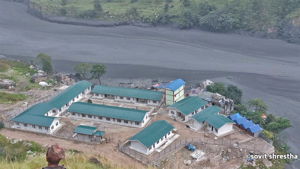
Flash Flood Sweeps Away Dozens of Homes in Gorkha, Nepal
KATHMANDU, Nepal — A sudden and severe flash flood tore through the Budhi Gandaki River basin in Gorkha district on Sunday morning, washing away approximately 35 houses and triggering widespread destruction in the mountainous Manaslu and Tsum Valley regions. According to local authorities and disaster management officials, no human casualties have been reported thus far, though…
-
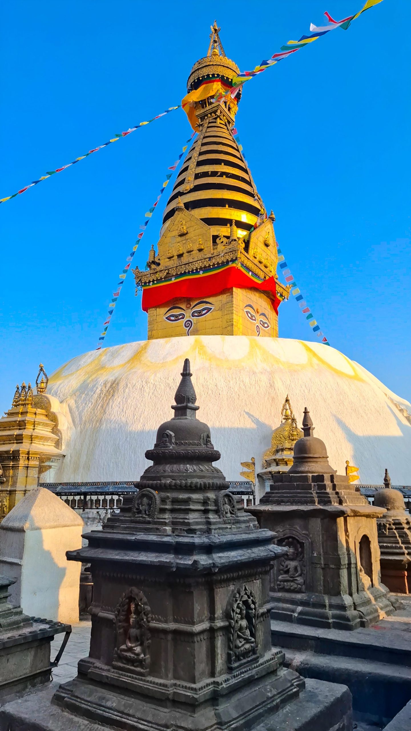
Swayambhunath Temple, Kathmandu
Imagine standing above the chaos of Kathmandu. Honking horns fade below you. A gleaming white dome rises ahead. Two enormous painted eyes gaze calmly in every direction. Prayer flags flutter in the Himalayan breeze. This is Swayambhunath, one of the most extraordinary places in Nepal. Visitors know it as the “Monkey Temple” because hundreds of…
-
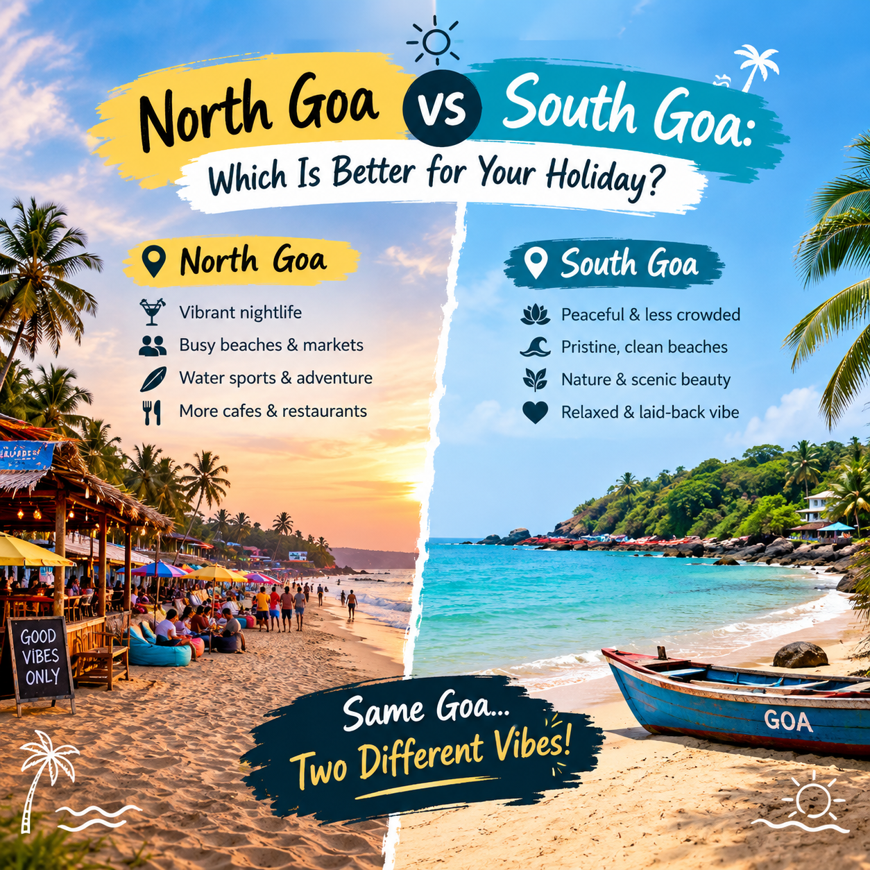
North Goa vs South Goa: Which Is Better for Your Holiday?
Amongst the places that are highly popular in terms of beaches, weather, culture, and ambiance in India is Goa, which is known to possess some of the most beautiful beaches in India. The idea of Goa being famous for its beaches, which can be used by tourists for entertainment in North Goa while South Goa…