
Gangapurna Lake(3,540 meter) Manang, Nepal
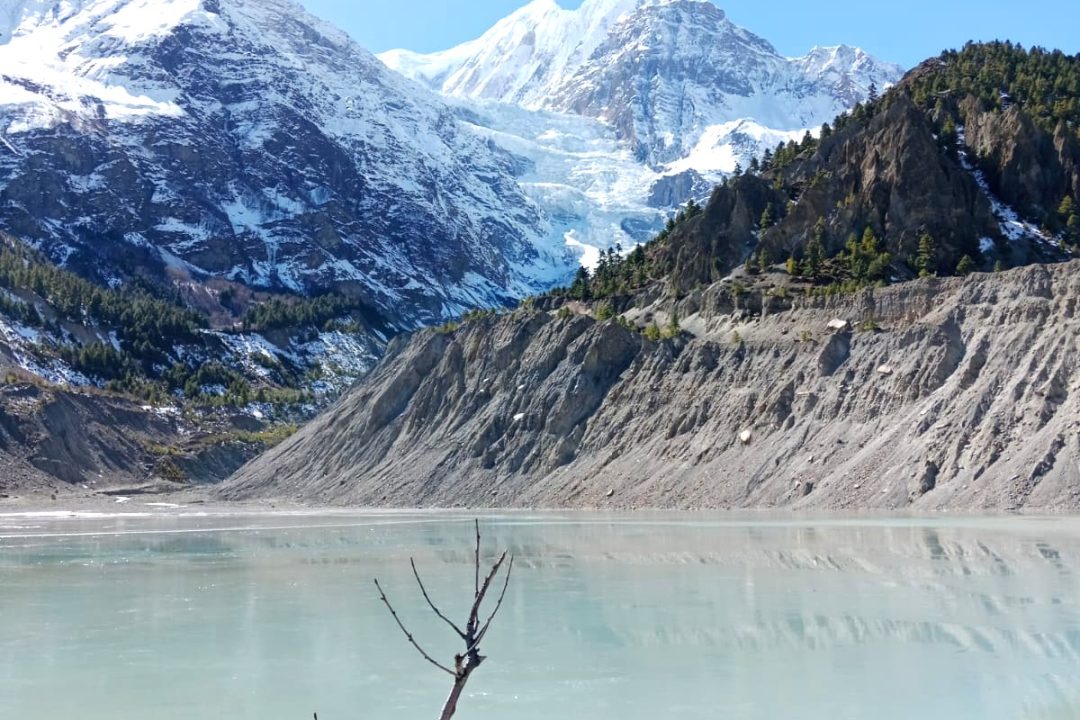
Gangapurna Lake is one of the most beautiful glacial lakes in Nepal. It is located just below Manang Village in the Annapurna region, featuring milky turquoise waters that are framed by towering ice and snow.
Most trekkers visit the lake during a rest day, and the walk to reach it takes less than an hour. The stunning views can leave a lasting impression for years to come.
This guide provides all the essential information you need about Gangapurna Lake, including its altitude, location, distance, and trail details. You will also find information on permits, costs, seasonal considerations, and safety tips.
Everything presented here is tailored for real trekkers – no fluff, just clear and useful details.
Table of Contents
Gangapurna Lake at a Glance
| Detail | Information |
| Name | Gangapurna Lake (Gangapurna Tal) |
| Type | Glacial lake |
| Gangapurna Lake altitude | About 3,540 m (11,614 ft) |
| Gangapurna Lake location | Manang, Manang District, Gandaki Province, Nepal |
| Coordinates | 28°39′50″N, 84°01′03″E |
| Surface area | About 21 hectares (52 acres) |
| Nearest village | Manang Village (3,519 m) |
| Gangapurna Lake distance from Manang | About 1 km, 20 to 30 minutes on foot |
| Fed by | Gangapurna Glacier and nearby icefalls |
| Protected area | Annapurna Conservation Area |
| Permit needed | ACAP |
| Best season | March to May, September to November |
| Difficulty | Easy short hike |
Gangapurna Lake Location: Where Exactly Is It?
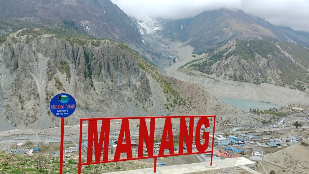
Gangapurna Lake is located directly beneath Manang Village, a well-known stop on the Annapurna Circuit. Manang is situated at an elevation of 3,519 meters (11,545 feet) in Manang District, Gandaki Province. The lake is positioned just south of the village and can be easily seen from the main trail.
The entire area is part of the Annapurna Conservation Area, which is Nepal’s largest protected region, encompassing forests, high valleys, and several peaks over 7,000 meters. Administratively, Gangapurna Lake falls within Nesyang Rural Municipality, and the district headquarters is located in Chame. The nearest large city is Pokhara.
Distance from major place
| From | Approximate distance | Travel time |
| Manang Village | 1 km | 20 to 30 min walk |
| Braga Village | 3.5 km | 1 hour walk |
| Chame | 30 km | 4 to 6 hours by jeep |
| Besisahar | 95 km | 9 to 11 hours by jeep |
| Pokhara | 180 km (road) | 1 to 2 days |
| Kathmandu | 290 km (road) | 2 days |
Road conditions change fast in the mountains. Always add buffer time to your plan.
Gangapurna Lake Altitude in Nepal
Gangapurna Lake is situated at an altitude of approximately 3,540 meters, which is about 11,614 feet above sea level. Some sources round this figure down to 3,500 meters. One record places the lake near Manang village at around 3,500 meters, fed by a glacier that slides down the slopes of Gangapurna. However, other sources state the elevation as 3,540 meters. The difference in these measurements is minor and does not impact planning for visitors.
Additionally, some operators mention a viewpoint above the lake at an altitude of 3,800 meters. This higher viewpoint offers a stunning perspective of the turquoise water, with the glacier and icefall visible behind it. Therefore, the elevations of the lake shore and the viewpoint are different.
Why the altitude matters
At an altitude of 3,540 meters, oxygen levels decrease significantly, providing only about 65 percent of the oxygen available at sea level. As a result, breathing may become more difficult during small climbs.
This altitude is still considered moderate, and most healthy individuals typically adjust within a day or two. However, it is important to respect the effects of altitude.
Avoid flying or driving directly to Manang and then attempting strenuous hikes. Instead, give your body time to acclimatize. The lake offers a perfect, gentle first walk to help with this adjustment.
The Gangapurna Glacier: The Ice That Made the Lake
The Gangapurna Glacier hangs above Gangapurna Lake, flowing off the north face of Mount Gangapurna, which stands at 7,455 meters (24,459 feet) in the Annapurna range. The glacier was first climbed in 1965 by a German expedition via the south face and east ridge.
At the glacier’s end is a steep icefall, where large blocks of ice break off during the warmer months. While standing on the shore, you may hear the distinctive cracks and booms as the ice shifts—this sound is one of the highlights of the trip, reminding you that the mountain is alive.
The glacier is shrinking
Unfortunately, the glacier is shrinking. Climate warming has taken a toll on Himalayan glaciers, and older photos show the ice reaching much closer to the water than it does today. Local guides often discuss this change, with many recalling a larger glacier from their childhood. Their stories are worth hearing.
Researchers closely monitor these glacial lakes due to the risk they pose. Growing glacial lakes can potentially burst, leading to what is known as a glacial lake outburst flood (GLOF). Gangapurna Lake is monitored for this reason, but there’s no need for concern. This monitoring underscores the importance of conservation fees in protecting the environment.
Why Visit Gangapurna Lake?
Nepal is home to many beautiful lakes, but Gangapurna Lake stands out for several reasons.
- Accessibility: While many high-altitude lakes require long treks, Gangapurna Lake is relatively easy to reach. Tilicho Lake requires additional hiking, while Gangapurna Lake is about a 30-minute walk from Manang.
- Imposing Scale: The lake sits below the impressive Gangapurna Mountain, which rises to 7,455 meters. The close view of the mountain creates a spectacular backdrop.
- Stunning Color: The lake can appear milky blue or bright turquoise in sunlight. Its changing colors make it a beautiful photography spot.
- Acclimatization: The hike to Gangapurna Lake provides a good opportunity to gain some altitude during your stay in Manang. Always follow a gradual acclimatization plan.
- Peacefulness: Many trekkers pass through Manang quickly. Spending some time at Gangapurna Lake can offer a peaceful break from the busy trail.
- No Extra Costs: There is no separate entry fee for Gangapurna Lake when you already have the required ACAP permit.
These features make Gangapurna Lake a beautiful place to visit during the Manang Trek.
How to Reach Gangapurna Lake
This is the most commonly searched question about the lake: how to reach Manang. Here is a comprehensive guide on your options.
Option 1: The Classic Annapurna Circuit Trek
This is the traditional route, where you walk for several days through diverse landscapes.
Start in Kathmandu or Pokhara and travel by bus or jeep to Besisahar (760 m). From there, proceed on foot or by vehicle up the Marsyangdi Valley. A typical walking itinerary looks like this:
- Besisahar to Chamje
- Chamje to Dharapani
- Dharapani to Chame (2,670 m)
- Chame to Pisang (3,300 m)
- Pisang to Manang (3,519 m)
After reaching Manang, take a rest day to hike to Gangapurna Lake. This trek typically takes about six to eight days from Besisahar, with the gradual ascent helping to prevent altitude sickness.
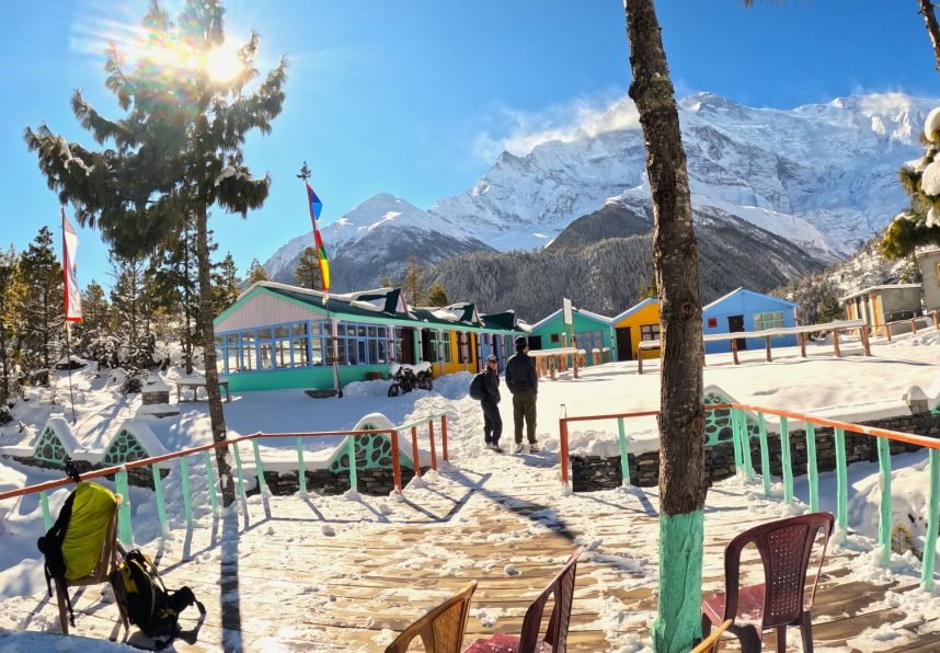
Option 2: Jeep Road to Manang
A rough road now leads directly to Manang, where shared jeeps operate between Besisahar and Chame. The journey from Besisahar to Chame takes about seven hours, and then, Chame to Manang adds an additional four to six hours. Many people choose to split this trip into two days.
This option saves time but increases the risk of altitude sickness due to the rapid elevation change from 760 m to 3,519 m. If you decide to drive, it’s advisable to rest for two full nights in Manang before hiking gently, avoiding direct ascents to Thorong La.
Option 3: Fly to Humde (Hongde)
Manang has a small airstrip at Humde, located at 3,401 m (11,158 ft). However, flights are seasonal and often unreliable, as weather conditions frequently lead to cancellations. Treat this as a bonus option, not a primary plan.
Once at Humde, it is a 2- to 3-hour walk to Manang, which is a flat and pleasant stretch.
Special note: There is no commercial flight operating to Humde now
Gangapurna Lake from Manang: The Hike Step by Step
Now for the short walk itself. This is the Gangapurna Lake hike most visitors do.
Trail summary
| Item | Detail |
|---|---|
| Start point | Manang Village main street |
| One-way distance | About 1 km |
| Round trip time | 45 minutes to 2 hours |
| Elevation change | 30 to 250 m, depending on route |
| Difficulty | Easy to moderate |
| Guide needed | Helpful but not essential |
| Best time of day | Early morning or late afternoon |
Step 1: Leave Manang Village
Begin your journey at the southern edge of the village. Look for signs pointing to the lake and glacier viewpoint. Most lodges can guide you. The path starts with a gentle descent as you pass stone walls and small fields.
Step 2: Cross the Stream
You will come across a small bridge that crosses the glacier’s outflow, where the water is cold and gray. Be cautious during the spring months when snowmelt increases the water flow. Take care as you step on the wet stones.
Step 3: Climb the Moraine
Next comes the only significant effort: a short incline of loose rocks. Take small steps and breathe steadily, as at this altitude, a slower pace is more effective. The climb will take about 10 to 15 minutes, and then the lake will suddenly come into view.
Step 4: Reach the Shore
The lake will spread out before you, with the glacier towering above and Manang behind you. Near the lake and viewpoint, you will find an information point with boards that explain the glacier and offer views of Annapurna IV, Gangapurna, and Tilicho Peak. Read the boards. They provide clear explanations about glacier retreat.
Step 5: Optional Climb to the Upper Viewpoint
If you’re up for it, a steeper path leads to a higher viewpoint above Gangapurna Lake. The extra effort is rewarded with a stunning view of the lake, the glacier, and the entire valley. Allow an additional 30 to 45 minutes for this round trip before returning to Manang for lunch.
Gangapurna Lake in Manang: Clarifying the Distances
People often encounter different distance measurements online, so here’s a clearer breakdown of the actual distances:
- The shore of Gangapurna Lake is approximately 1 km from central Manang, which takes about 20 to 30 minutes to walk.
- The upper viewpoint is around 2 km away and requires about 60 to 90 minutes to reach one way.
- A full loop that includes the Chongkor viewpoint covers 4 to 5 km and typically takes around three hours to complete.
All the distance numbers are correct; they simply refer to different endpoints along the way.
A quick comparison of Manang day hikes
| Hike | Altitude reached | Round trip |
|---|---|---|
| Gangapurna Lake | ~3,540 m | 1 to 2 hours |
| Gangapurna viewpoint | ~3,800 m | 2 hours |
| Chongkor viewpoint | ~3,900 m | 2 to 3 hours |
| Praken Gompa | ~3,950 m | 3 hours |
| Ice Lake (Kicho Tal) | 4,620 m | 6 to 8 hours |
| Tilicho Lake | 4,919 m | 2 to 3 days |
A common strategy for acclimatization is to spend two nights in Manang. On the first day, you can take an easy hike to either Praken Gompa or Gangapurna Lake. On the second day, you can tackle the more challenging climb to Ice Lake/Milarepa Cave. This plan is effective, so if you have the time, be sure to follow it.
Gangapurna Lake Trek: Full Itineraries
Here are three practical plans. Choose the one that fits your schedule.
Itinerary A: Annapurna Circuit including Gangapurna Lake (14 days)
Day 1: Arrival in Kathmandu
Day 2: Drive from Kathmandu to Besisahar
Day 3: Drive from Besisahar to Chame
Day 4: Trek from Chame to Pisang
Day 5: Trek from Pisang to Manang
Day 6: Acclimatization in Manang and Gangapurna Lake Exploration
Day 7: Trek from Manang to Yak Kharka
Day 8: Trek from Yak Kharka to Thorong Phedi
Day 9: Cross Thorong La Pass and Trek to Muktinath
Day 10: Drive from Muktinath to Jomsom
Day 11: Drive from Jomsom to Tatopani
Day 12: Drive from Tatopani to Pokhara
Day 13: Drive from Pokhara to Kathmandu
Day 14: Departure from Kathmandu
Itinerary B: Short Gangapurna Lake Manang trek (7 days)
Day 1: Drive from Kathmandu to Chame by private jeep.
Day 2: Trek from Chame to Pisang.
Day 3: Trek from Pisang to Manang Village.
Day 4: Acclimatization and Exploration in Manang. Hike to Gangapurna Lake and visit Braga Monastery.
Day 5: Optional Day Hike to Ice Lake or Milarepa Cave.
Day 6: Drive from Manang to Besisahar by jeep.
Day 7: Drive from Besisahar to Kathmandu or Pokhara.
This suits travellers with limited time. You skip Thorong La entirely.
Itinerary C: Fast jeep trip (5 days)
Day 1: Drive from Kathmandu to Chame by jeep.
Day 2: Drive from Chame to Manang by jeep.
Day 3: Rest and Acclimatization Day in Manang. Take a short village walk.
Day 4: Hike to Gangapurna Lake and the Upper Viewpoint.
Day 5: Drive from Manang back to Besisahar by jeep.
Only choose this if you must. Rapid ascent carries real risk.
Best Time to Visit Gangapurna Lake
The choice of season significantly impacts your experience at Gangapurna Lake. Below is a month-by-month overview:
Spring: March to May
This period is one of the two best times to visit. Mornings typically feature clear skies, and daytime temperatures are mild, although nights can still drop below freezing. Rhododendrons bloom lower down the mountains, adding vibrant colors to the landscape. In March, the lake may still hold floating ice, creating stunning photo opportunities. As April approaches, crowds begin to increase, so it’s advisable to book accommodations early if you plan to travel during this time.
Summer and Monsoon: June to August
Rain dominates the lower valley during these months, leading to muddy trails and the presence of leeches below 2,500 meters. However, Manang is located in a rain shadow and receives significantly less rainfall compared to Besisahar, making the trek still feasible. Be aware that clouds may often obscure the peaks, leading to common road landslides and frequent flight cancellations. If you decide to visit during this season, ensure you have flexible travel dates.
Autumn: September to November
This is peak season and arguably the best overall time to visit. The air is clear after the monsoon, providing reliable and sharp views. Temperatures are comfortable, and festivals such as Dashain and Tihar occur during this time. However, the downside is the influx of tourists, with October being the busiest month on the trekking circuit. It is wise to book accommodations in advance and start your hikes early each day.
Winter: December to February
During winter, the lake is quiet and often frozen, transforming the scenery into a dramatic white landscape. However, the cold can be severe, with nighttime temperatures in Manang dropping as low as -15°C. Many lodges close during this time, and Thorong La may become blocked by snow. Visiting in winter is best suited for experienced trekkers, so ensure you bring the proper gear.
Best Time of Day
The morning light is soft and clear, with calm winds typically present before 10 a.m. By the afternoon, winds tend to pick up significantly, creating blustery conditions around the lake. Late afternoon always brings warm, golden light, but be sure to return before dark.
Altitude Safety: Important Information for Every Visitor
This section is important for everyone visiting Gangapurna Lake and Manang.
Understanding Acute Mountain Sickness (AMS)
Acute Mountain Sickness occurs when you ascend too quickly for your body to acclimatize. It can begin above 2,500 meters (8,200 feet). Since Manang is above this elevation, AMS is a genuine concern.
Common Early Symptoms
- Persistent headache
- Loss of appetite
- Nausea
- Poor sleep
- Unusual fatigue
- Dizziness
Mild symptoms are common and may improve with rest and hydration.
Serious Warning Signs
- Confusion or unusual behavior
- Loss of balance while walking
- Breathlessness while resting
- A wet or bubbling cough
- Severe or persistent headache
These symptoms can indicate a serious altitude-related condition. Descend immediately and seek medical help.
Simple Rules for Safety
- Ascend slowly above 3,000 meters.
- Avoid increasing your sleeping altitude too quickly.
- Hike higher during the day and return to a lower altitude to sleep.
- Drink enough water throughout the day.
- Avoid alcohol at high altitudes.
- Eat regular, nutritious meals.
- Never leave someone who feels seriously unwell alone.
- Descend if symptoms worsen.
Use the HRA clinic in Manang
The Himalayan Rescue Association runs a clinic in Manang. Staff give free daily altitude talks in season. Attend one. The talk is short and genuinely useful. The clinic also treats trekkers. It has saved many lives on this route.
Insurance
Buy travel insurance before you come. Make sure it covers trekking above 4,000 m. Check that helicopter evacuation is included. Rescue costs thousands of dollars without cover.
Permits and Rules for Gangapurna Lake
You do not need a special permit for the lake. But you need permits for the region.
Annapurna Conservation Area Permit (ACAP)
To visit the Gangapurna lake trekkers need to obtain this ACAP permit. This permits cost NPR 3,000 for foreign nationals, for SAARC nationals NPR 1,000 and for Nepalese NPR 100 per person.
This permit is single-entry, and it is non-refundable and non-transferable. Rangers at the check post check the permit, and you need to carry this permit with you at all times. Without a permit, trekking is illegal, and you might be fined.
Where to get permits
Nepal Tourism Board Locations:
- Bhrikutimandap, Kathmandu
- Damside, Pokhara
You can obtain your trekking permits through:
- A registered trekking agency
- Online portals, where available
Please remember to bring the following:
- Your passport
- Passport-sized photos
- Nepali rupees in cash
You also have the option to apply online with the assistance of a tour agency.
Guide requirement
A guide is required only for restricted treks. For these treks, you can choose to go solo without hiring a guide. Typically, when you purchase a package from a trekking agency, a guide is included in the package. However, we also recommend having a guide for your own safety and security.
Cost of a Gangapurna Lake Trip
Budgets can vary significantly. Here is a realistic budget range for a mid-level trekker.
| Item | Cost per person (USD) |
| ACAP permit | 30 to 35 |
| Jeep, Kathmandu to Manang( round trip) | 600 |
| Teahouse room per night | 20 to 30 |
| Meals per day | 30 to 40 |
| Hot shower | 3 to 4 |
| Guide per day | 30 to 35 |
| Porter per day | 20 to 25 |
| Travel insurance | 80 to 100 |
A seven-day independent trip often costs USD 900 to 1,600.
Prices rise with altitude. Everything is carried or driven up. Be patient with that. Carry cash. There is an ATM in Manang, but it fails often.
What to Pack for the Gangapurna Lake Hike
You do not need heavy gear for the lake itself. But Manang demands warm clothing.
Clothing
- Base layers, merino or synthetic
- Fleece or light down mid-layer
- Waterproof and windproof jacket
- Trekking trousers
- Warm hat and sun hat
- Gloves
- Good trekking socks
Footwear
- Broken-in trekking boots with ankle support
- Camp shoes or sandals for the lodge
Essentials
- Sunglasses with UV protection
- High-factor sunscreen
- Lip balm with SPF
- Refillable water bottle
- Water purification tablets or filter
- Headlamp with spare batteries
- Power bank
- Basic first aid kit
- Personal medication
Nice to have
- Trekking poles
- Camera with a wide lens
- Lightweight binoculars
- Snacks from Kathmandu or Pokhara
Manang has a high-altitude cold desert landscape, which means the day temperature is warm, while at night the temperature often remains cold. Waste management facilities are limited, so please carry your waste with you and dispose of it only in designated areas.
Where to Stay and Eat in Manang
Manang has the best teahouse with is fully equipped on the entire circuit. There are plenty of choices from budget to luxury.
Accommodation
- Teahouses line the main street. Rooms are simple but clean. Most have twin beds and shared bathrooms.
- Some lodges now offer attached bathrooms. These cost more. They are worth it in cold months.
- Expect NPR 3000 to 5,000 per room. Prices often drop if you eat at the lodge.
Food
- Dal bhat is the staple. Rice, lentils, vegetables and pickle. Refills are usually free.
- You will also find pasta, pizza, momos and soups. Bakeries sell apple pie and cinnamon rolls.
- Manang even has small cinemas. They show mountaineering films in the evening.
Practical tips
- Book ahead during the peak season( spring and autumn)
- Carry some Nepalese currency for tips and personal expense.
- Get the list for breakfast in the evening so that you can trek early in the morning.
- Taking meat items is generally not recommended at high altitude due to lack of refrigerator.
- Fill your water bottles with hot water, if you normal water use water purification tablet.
Things to Do Near Gangapurna Lake
The lake pairs well with other short trips. Here are the best options.
Braga Monastery
- Distance: 3.3 km one way
- Duration: 30–45 minutes( keep 2 to 3 hours for exploration and visit)
- Elevation: Braga monastery is situated approximately 3,540 meters
- Significance: It is over 500 year old Buddhist monastery
Praken Gompa
- Distance: 3 km one way
- Duration: 3 to 4 hour round trip ( keep 5 to 6 hours for exploration and visit)
- Elevation: Praken Gompa is situated approximately 3,945 to 4,100 meters
- Significance: The 100 Lama Cave Monastery is a well-known stop for trekkers seeking a blessing before they tackle the challenging Thorong La Pass. Resident monks or Aani offer blessings to the visitors, as it is believed that these blessings bring fortune, spiritual protection, and safety.
Ice Lake (Kicho Tal)
- Distance: 17 to 18 km
- Duration: 7 to 9 hours( round trip)
- Elevation: Ice lake is situated approximately 4,620 meters
- Significance: Visitors can witness the incredible view of Annapurna III (7,555m) and Gangapurna (7,455m).
Milarepa Cave
- Distance: 8 to 10 km
- Duration: 4 to 5 hours( round trip)
- Elevation: Milarepa Cave is situated approximately 4,135m to 4,300m
- Significance: The Meditation Cave of Kera Gompa is significant; Dorjee, a great yogi, spent years practicing meditation there for spiritual growth.
Chongkor viewpoint
- Distance: 3 to 4 km
- Duration: 2 to 3 hours( round trip)
- Elevation: Chongkor viewpoint is situated approximately 3,800 m
- Significance: Panoramic view of Annapurna III, Gangapurna, Tilicho Peak, and Pisang Peak,. Bird view of Gangapurna Lake and Manang village.
Tilicho Lake
- Distance: 40 to 41 km
- Duration: 2 to 3 days of trek
- Elevation: Tilicho Lake viewpoint is situated approximately 4,919 meters
- Significance: Hinduism and Buddhism consider Tilicho lake as a sacred site. From here you can enjoy close view of Tilicho Peak(4,919 meters) and surrounding giants like the Annapurna range, Nilgiri Himal, and Gangapurna.
Manang Cultural Museum
- Distance: 1.3 km
- Duration: 20 to 30 minutes
- Elevation: Manang Cultural Museum is situated approximately 3,540 meters
- Significance: Unique heritage, artifacts, local dress, tools and photos. It explains Manangi trade history. Entry is cheap.
Culture and People of Manang
The lake is located within a unique cultural landscape, and understanding this context can enhance your visit.
The Manangis are a Buddhist community influenced by Tibetan culture. Their language and traditional dress are distinct from those of lowland Nepal. For centuries, they engaged in trade across the Himalayas, and in the 1960s, Nepal granted them special trading rights. As a result, many families traveled extensively throughout Asia.
The history of the Manangis is evident in the village, where you will find prayer wheels, chortens, and mani walls.
Simple etiquette
- Walk clockwise around chortens and mani walls.
- Ask before photographing people.
- Remove shoes inside monasteries.
- Dress modestly in villages.
- Do not touch religious objects.
- Give donations quietly, not for show.
Respect goes a long way. Locals are generous when treated well.
Photography Tips for Gangapurna Lake
This is a rewarding place for photographers. A few tips help.
- Shoot early. Morning light is clean and the water is still.
- Use a polarizer. It cuts glare and deepens the turquoise.
- Include a person. Scale is hard to show without one.
- Try the upper viewpoint. It gives lake, glacier and village in one frame.
- Bracket exposures. Snow and shadow together fool the meter.
- Protect batteries. Cold drains them fast. Keep spares inside your jacket.
- Watch for icefall. A calving block makes a dramatic shot. But never approach the ice.
- Respect drone rules. Drones need permits in the conservation area. Check first.
Responsible Travel at Gangapurna Lake
This landscape is fragile. Your choices matter.
Waste
- Take everything you bring in back with you, including wrappers, tissues, and batteries.
- Avoid single-use plastic bottles; instead, use water purification systems. Manang has refill stations available.
Water
- Please do not bathe or wash with soap in the lake or streams. Use the lodge facilities instead.
Wildlife
- Blue sheep and Himalayan griffons live nearby. Please watch quietly from a distance.
- Never feed the animals, as it can change their behavior permanently.
Swimming
- Many visitors take a quick dip, and some daring individuals have been seen swimming in the icy waters. However, this can be very risky.
- The near-freezing water can cause cold shock within seconds, and help may be far away. Most guides strongly advise against swimming. Instead, it’s best to enjoy the view.
Supporting locals
- Stay in family-run lodges, purchase local crafts, and hire local guides and porters.
- Ensure fair wages are paid and inquire about porter insurance before booking.
Common Mistakes Visitors Make
Learn from others. These errors are frequent.
- Rushing up by jeep. Fast ascent causes most altitude problems on this route.
- Skipping the rest day. Manang rest days exist for a reason. Use them.
- Hiking in the afternoon wind. Mornings are far more pleasant.
- Underestimating the sun. UV is intense at 3,500 m. Sunburn happens fast, even in cloud.
- Bringing too little cash. Card payment barely works here.
- Ignoring thin trail edges. The moraine slope has loose rock. Watch your footing.
- Wearing new boots. Blisters ruin treks. Break boots in at home.
- Leaving too late in the day. Darkness arrives quickly in mountain valleys.
Who Should Visit Gangapurna Lake?
The hike itself is easy. The altitude is the filter.
- Families: Suitable for children over about 10, if well acclimatized. Watch them near the moraine edge.
- Older travellers: Very doable with slow ascent. Many people in their 60s and 70s complete it.
- Beginner trekkers: Ideal. It is short, scenic and low-commitment.
- People with heart or lung conditions: Consult a doctor first. Altitude adds real stress.
- Pregnant travellers: Seek medical advice before going above 3,000 m.
Fitness helps, but patience helps more.
A Perfect Day Plan in Manang
Here is a simple, well-paced rest day.
6:30 a.m. Wake and drink warm water. Watch sunrise on Annapurna III.
7:30 a.m. Breakfast at your lodge. Eat carbohydrates.
8:30 a.m. Walk to Gangapurna Lake. Take it slowly.
9:15 a.m. Arrive at the shore. Read the information boards.
10:00 a.m. Climb to the upper viewpoint for wider views.
11:30 a.m. Return to Manang along the ridge path.
12:30 p.m. Lunch and rest.
3:00 p.m. Attend the HRA altitude talk.
4:30 p.m. Visit the bakery or the museum.
6:30 p.m. Early dinner and hydration.
8:30 p.m. Sleep. Your body recovers at night.
This plan follows the climb-high, sleep-low principle. It is safe and satisfying.
Frequently Asked Questions
What is the Gangapurna Lake altitude in Nepal?
- Gangapurna lake sits at roughly 3,540 metres, or about 11,614 feet.
Where is Gangapurna Lake located?
- It lies in Manang District, Gandaki Province, Nepal. The lake sits just below Manang Village.
How do I reach Gangapurna Lake?
- Reach to Besisahar or Chame by drive and start trek or direct reach to Manang Village by hiring Private Jeep 4*4.
What is the Gangapurna Lake Manang distance?
- The shore is about 1 km from the village centre. The walk takes 20 to 30 minutes.
How long is the Gangapurna Lake hike?
- A basic round trip takes 45 minutes to 2 hours. Adding the upper viewpoint makes it 2 to 3 hours.
Is the Gangapurna Lake hiking trail difficult?
- No. It is easy for most people due to short distance and duration from Manang Village.
Do I need a permit for Gangapurna Lake?
- No separate permit exists. Your ACAP permit for the Annapurna region covers it.
How much does the ACAP permit cost?
- It costs NPR 3,000 for foreign nationals. SAARC nationals pay around NPR 1,000.
Do I need a guide?
- While not legally required, hiring locally promotes safety and boosts the local economy, as many residents depend on tourism.
What formed Gangapurna Lake?
- Meltwater from the Gangapurna Glacier and neighbouring glaciers created it. Moraine holds the water in place.
How tall is Mount Gangapurna?
- It stands at 7,455 metres, or 24,459 feet. It ranks 59th among the world’s highest peaks.
When is the best time to visit?
- March to May and September to November are best. Skies are clearest then.
Is the lake frozen in winter?
- It often freezes partly or fully between December and February. The scene looks striking.
Can I swim in Gangapurna Lake?
- It is strongly discouraged. The water is near freezing and rescue is far away.
Is there mobile signal at the lake?
- NTC works perfectly in Manang, while NCELL has patchy service in the area. The mobile network quality varies depending on your location.
Can I visit Gangapurna Lake without doing the full Annapurna Circuit?
- Yes. A short jeep-and-trek plan takes about six to seven days from Kathmandu.
Is Gangapurna Lake the same as Tilicho Lake?
- No. Tilicho sits much higher at 4,919 m and needs a multi-day detour.
How does Gangapurna Lake compare to Ice Lake?
- Gangapurna is lower and far easier. Ice Lake sits at 4,620 m and needs a full day hike.
Are there toilets at the lake?
- No. Use facilities in Manang teahouse/lodge before you leave.
What should I do if I get a headache in Manang?
- Rest, drink water and avoid climbing higher. Descend if it worsens or new symptoms appear.
Can I see the glacier from the lake?
- Yes. The Gangapurna Glacier and its icefall sit directly above the water.
Is Gangapurna Lake worth visiting?
- Yes. It offers huge mountain views for very little effort.
Final Thoughts
Gangapurna Lake demonstrates that stunning views don’t always require strenuous effort. A short walk from Manang offers a breathtaking panorama of the Himalayas. The lake’s turquoise waters are set against a backdrop of a 7,455-meter peak, with ice hanging above it and the valley stretching below. It’s important to respect the altitude. Walk slowly, stay hydrated, and take a rest day. Take some time to sit by the shore and listen to the cracking of the glacier. Those quiet moments are the real reward. Remember to pack out your waste, support local lodges, and leave the shoreline as you found it. The glacier is shrinking each year, so visiting thoughtfully is the least we can do.
-
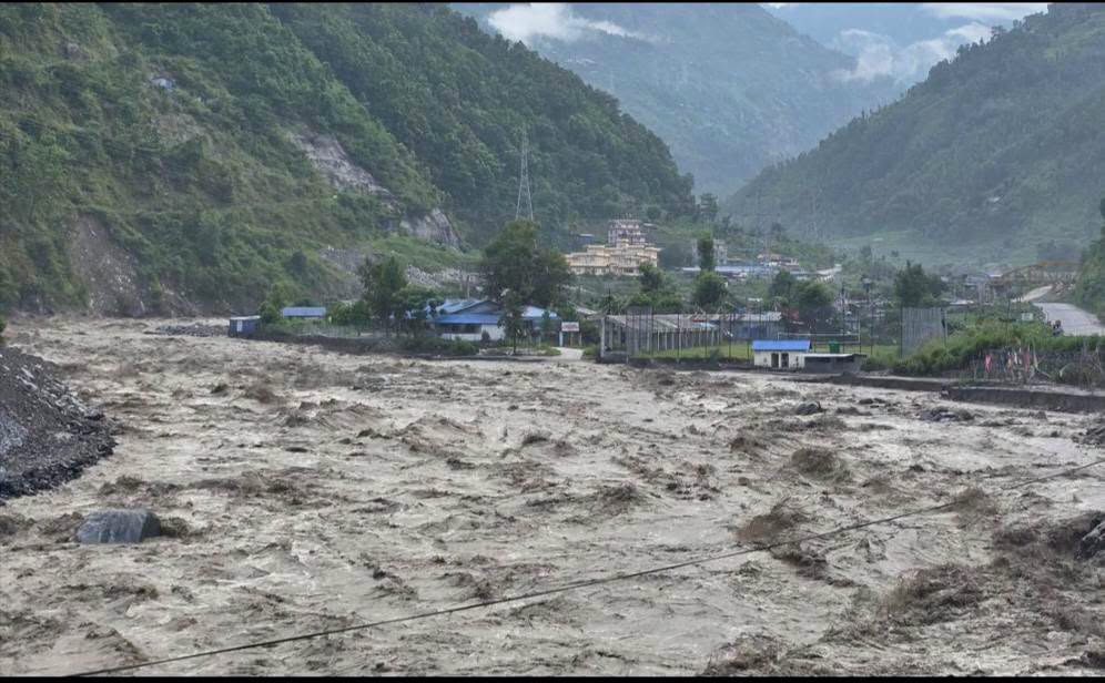
Catastrophic Flash Floods Strike Rasuwa around 9:00 AM on Wednesday, August 26
RASUWA: Early this morning, around 9:00 AM, flash floods originating from the Tibetan side affected parts of Rasuwa District, including Timmure, Rasuwagadhi, and Syabrubesi. The floods have caused significant damage, displaced residents, and disrupted traffic along important supply routes in the area. The death toll from the devastating Bhote Koshi flood reached 1,390 as of…
-
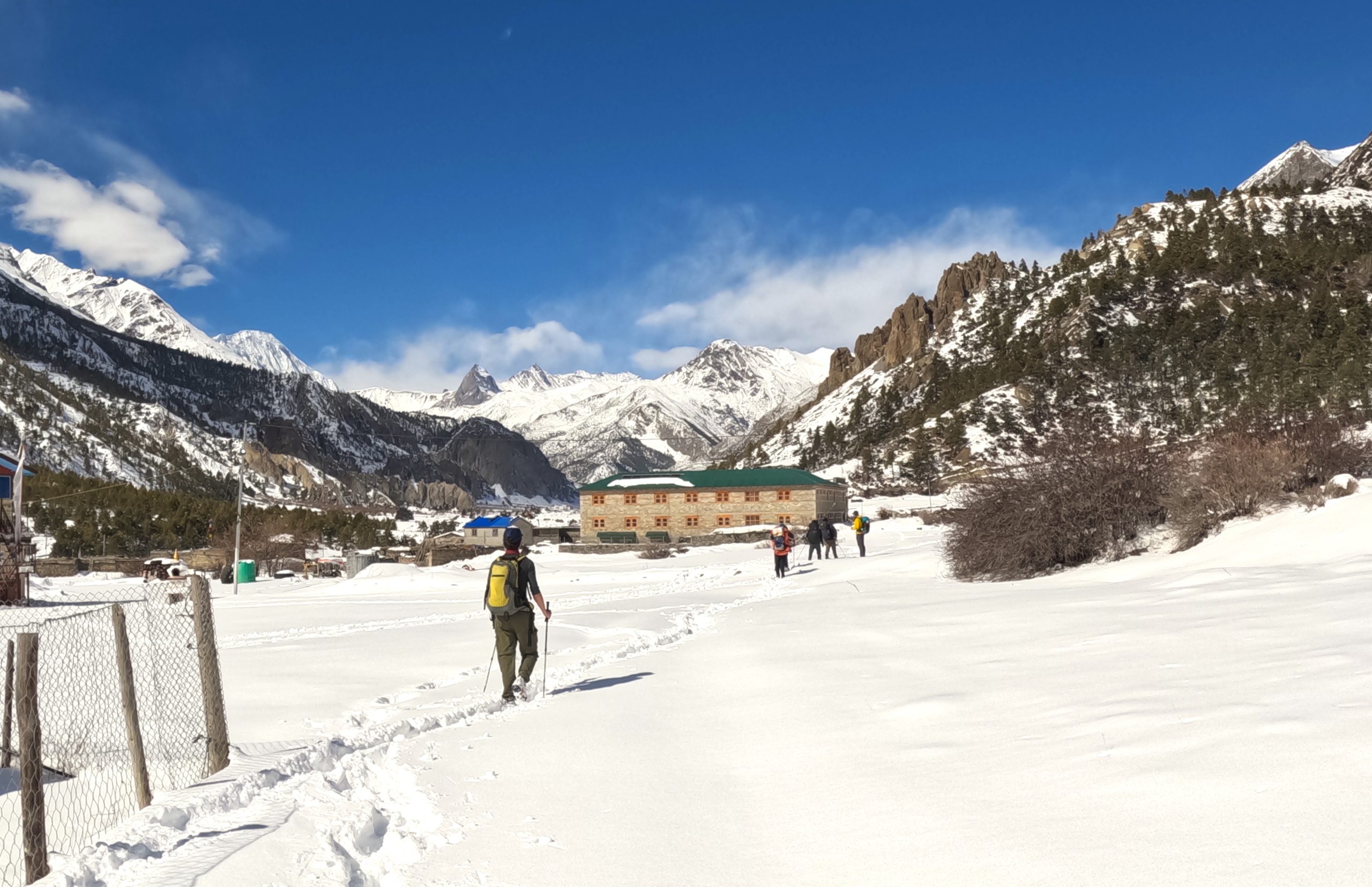
Is the Annapurna Circuit Trek Beginners Friendly?
Introduction The Annapurna Circuit is a world-famous trail located in the Annapurna region within the Annapurna Conservation Area of Gandaki Province. It circles the Annapurna range and offers breathtaking views of the Annapurna, Dhaulagiri, and Manaslu mountain ranges. The highest point that you will reach on this trek is Thorong La Pass at 5,416 meters…
-
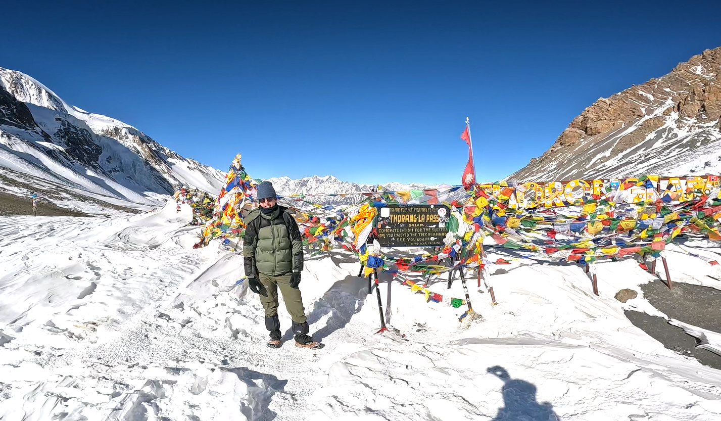
Thorong La Pass: Altitude, Location, Difficulty & Crossing Tips
I. Introduction There’s a moment on the Annapurna Circuit when trekkers feel a surge of excitement and exhaustion at the same time. The breathing becomes heavy here, and the wind starts to blow strongly. You can hear your own heavy breath, and when you look around, you see prayer flags snapping against a brutally blue…