World’s Eight Highest Peaks In Nepal Above 8000m
‘World tallest peaks located in Nepal Himalaya’
There are the 14 highest mountain in the world which is above 8, 000 meters or 26, 246.72 feet.
Where world eight tallest peaks located in Nepal likewise number one Mt. Everest at 8,848 m / 29,028 feet, world 3rd high Mt. Kanchenjunga 8, 586 m / 28, 169 feet, 4th Mt. Lhotse 8,516 m / 27, 940 feet, 5th highest Mt. Makalu 8,463 m / 27, 766 feet and 6th Mt. Cho-Oyu at 8, 201 m / 26, 906 feet,
7th high Mt. Dhaulagiri 8,167 m / 26, 795 feet, 8th Mt. Manaslu at 8,163 m / 26, 781 feet and the last world 10th highest
Mt. Annapurna 8,091 m / 26, 545 feet high.
The 1955 elevation of Everest, 29,028 ft. (8,848 m), was revised on Nov. 11, 1999, at 29,035 ft. (8,850 m).
However, the present height was declared jointly by both Nepal and Chinese Survey Department at 8, 848, 86 m, and 29, 032 feet.
Where most of the tallest mountain range is located around Nepal Mid and towards Far East region, similarly other major high mountains situated around Nepal Mid-West Himalaya.
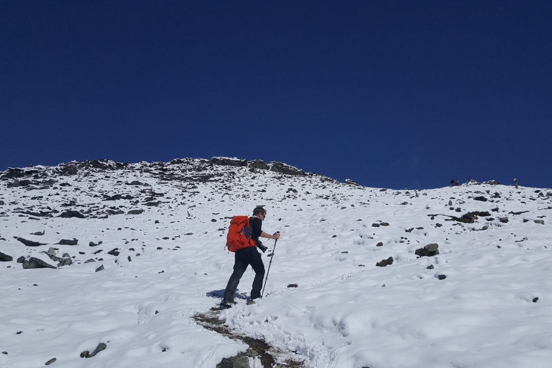
Nepal Himalaya capturing the world’s eight highest peaks certainly makes one of the most sought adventure activities and for leisure holidays on this planet earth.
Besides, world’s tallest mountains Nepal is also famous and renowned for other below 8, 000-meter peaks. Which makes Nepal Himalaya a paradise for expert mountaineers, and as well for beginners offering with wide range of peaks to climb.
Nepal with the highest mountain range draws thousands of mountaineers and trekkers to enjoy dramatic panorama, as well for big challenge to reach the summit of world-famous peaks.
Most world’s tallest mountains in Nepal are located north of the country, where Everest, Lhotse, Makalu, and Cho-Oyu straddles the border with Tibet / China.
Likewise, the world’s 3rd highest Mt. Kanchenjunga stands on the borderline of Nepal and Sikkim (a small North East state of India).
Where’s Dhaulagiri, Manaslu, and Annapurna located wholly within Nepal itself.
Moreover, Nepal and its Himalaya captures hundreds of mountain range of above and below 7, 000 m peaks that runs parallel from Far East to Fat West of the country.
Table of Contents
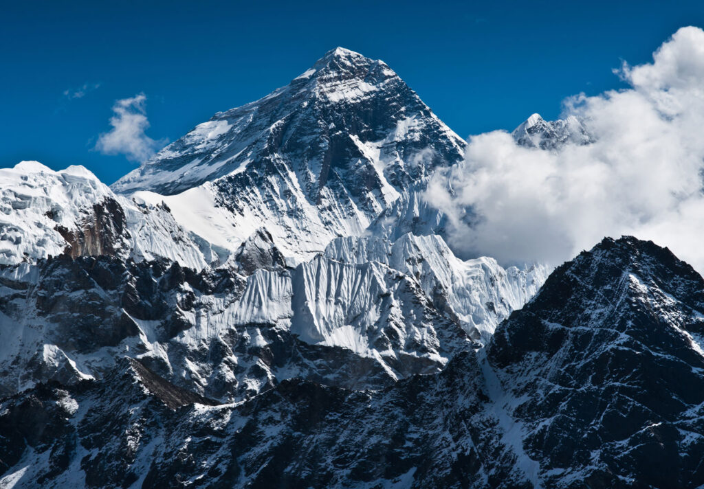
1. Mount Everest (Sagarmatha) – 8,848.86 meters / 29,031 feet
‘world’s number one tallest peak’
Overview:
Mt. Everest, the world’s numero uno the highest peaks on this planet earth.
Stands proudly at the height of 8, 848 m and 29, 028 feet high soaring high above the crystal blue sky.
A mountain with many names in the early days known as Peak XV (15), later renamed as Mt. Everest in honor to late Sir George Everest, a British surveyor of India of early 1830. In Nepal known as Sagarmatha and the Sherpa of Everest as well as Tibetans calls by the name Chomolungma, in both languages means a ‘Great Mother’.
In the late 1980’s National Geographic named as the Third Pole.
Mt. Everest is located in Nepal North Mid-East within Mahalangur Himal, a sub-range of greater Himalayas.
Mount Everest latitude and longitude at 27.9881° North and 86.9250° East the North Col, lies within Tibet / China, and the south face falls within Nepal in the district of Solu-Khumbu.
Mt. Everest’s first successful ascent on May 29th 1953 climbed by late legendry Tenzing Norgay Sherpa and Edmund Hillary with British Expedition to Mt. Everest.
The present altitude of Mt. Everest at 8848.86 meters and near about 29,032 feet high.
The revised new and present height was declared on December 8, 2020, by both Nepal and Chinese officials.
The higher side of Mt. Everest and its scenic area situated in Khumbu and within Sagarmatha National Park, the park was added to the list of World Heritage Sites in 1979 covers an area of 1,148 SQ. KMS.
One of the most popular and famous Himalayan adventure destinations of Nepal among adventurers, trekkers, and mountaineers.
Mt. Everest and Khumbu area offers ever-exciting places for adventure. The most popular trek is Everest base camp and climb to high Kalapathar hill, where trekkers can view Mt. Everest at its closest distance.
The other short adventure is the trek to scenic Tengboche Monastery of a week-long duration.
Everest region offers beautiful destination Gokyo Lake and its magnificent valley, as well as crossing the high Cho-La pass.
The high Khumbu valley of Everest provides various options for adventurous people likewise ‘Everest Three High Pass’ treks.
Besides its scenic views and panorama of giant peaks, it is also famous for the local Sherpa culture and heritage of Tibetan Buddhism and warm hospitality.
Places to visit around Mt. Everest region:
- Everest Base Camp and climb of Kalapathar.
- Short trek to Tengboche Monastery for Everest Panorama.
- Gokyo Valley and the lakes with climb of Gokyo-Ri.
- Gokyo Valley to Everest base camp via Cho-La Pass.
- Everest Three High Passes trek (Kongma, Cho-La and Renjo-La)
- Peekay Hill top trek and Classic Everest from Jiri.
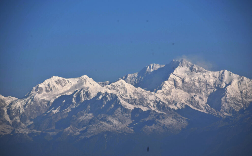
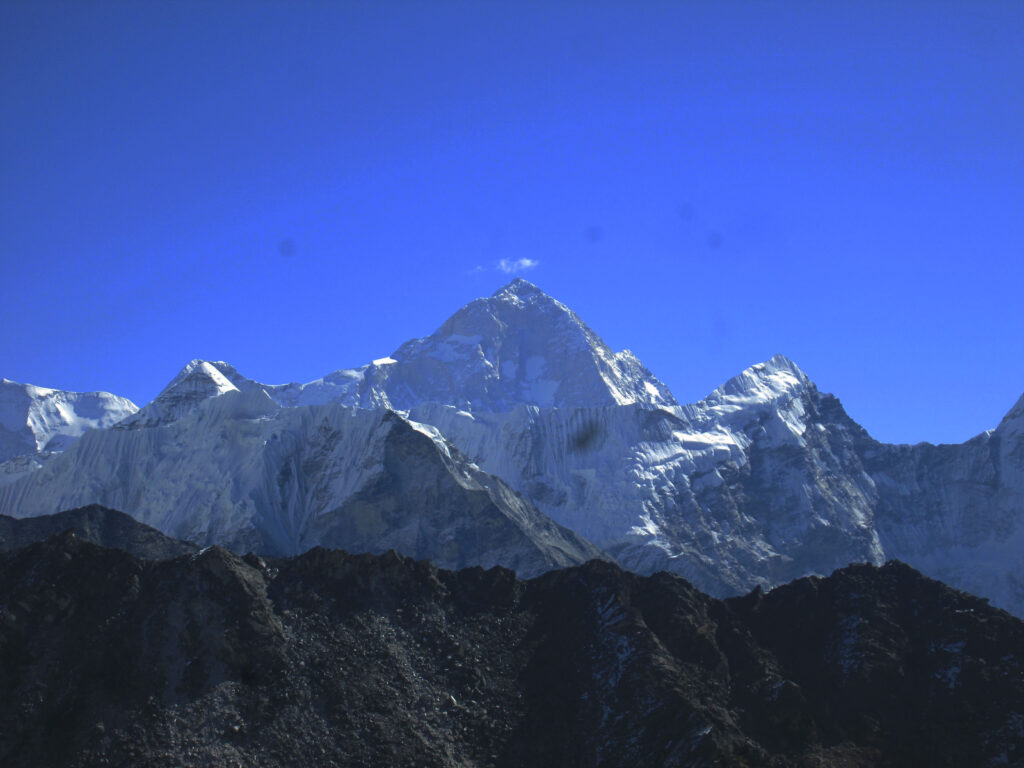
2. Kanchenjunga – 8,586 meters / 28,169 feet
‘World 3rd highest and Nepal 2nd high mountain’
Overview:
Mt. Kanchenjunga, listed as the world’s 3rd highest peaks and Nepal’s 2nd tallest mountain, rises at a height above 8, 586 m and 28, 169 feet.
Mount Kanchenjunga, located in Nepal Far East within the Great Himalayan range at about 125 km and 78 miles further east of Mt. Everest.
The massive bulk of Kanchenjunga also straddles the border between Nepal and Sikkim (a small North East state of India).
However, the most prominent location of Mt. Kanchenjunga falls within Nepal while the southeastern face belongs to Sikkim-India.
The mountain was first conquered by the late George Band, Norman Hardie and
S, Streather with British Expedition in May 25th 1955, which was climbed from Nepal south base camp of Kanchenjunga.
Kanchenjunga a massive bulk of a mountain with the main five peaks adjoin by other satellite lesser peaks, actually the name pronounced and spelled ‘Kanchendzonga’ from Tibetan language.
The main five peaks resemble jewels or elements Gold, Silver, precious stones, grain, and Holy Scriptures.
Mt. Kanchenjunga and its scenic area falls within the Latitude of 27.7025 and Longitude 88.1475 with 27°4256’ N and 87°55’42 due East, and it covers an area of 20,35 km2 (786 sq miles) in the district of Taplejung and Mechi State / Zone.
Mt. Kanchenjunga offers a great range of adventure, and the longest duration trek of more than three weeks, visiting both North and south base camps.
One of the most beautiful adventures around Kanchenjunga, where trekkers can enjoy exciting walks through dense deep forest, lined with tall rhododendron and pine trees to reach remorseless fields of ice and glaciers at Kanchenjunga base camps.
For interested travelers can trek beyond Kanchenjunga on the far-flung corners around Walunchung-Gola and crossing high Lumba-Sumba-La pass.
Kanchenjunga region a great way to explore local culture in the close backdrop of massive Himalayan range of peaks, provides complete wilderness in the harmony of pristine surroundings.
Places to visit around Kanchenjunga region:
- Kanchenjunga Circuit trek (both North and South base camps.)
- Short Prativara a cultural and scenic trek.
- Walungchun-Gola and Lumba-Sumba La Pass trek.
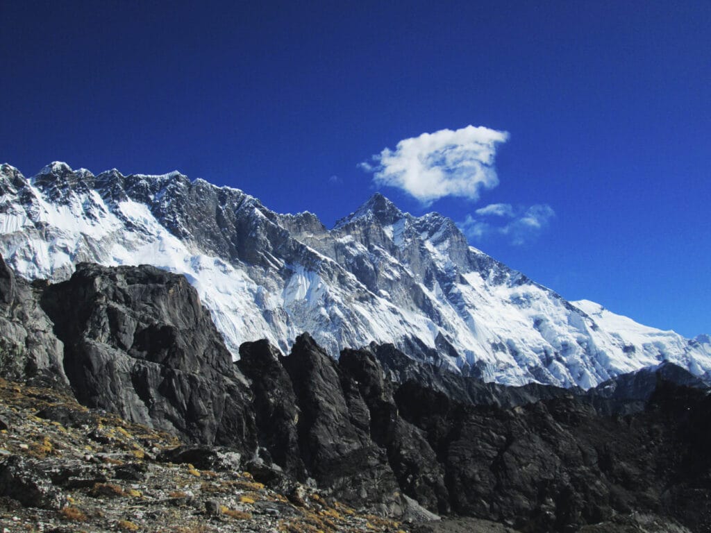
3. Lhotse – 8,516 meters / 27,940 feet
‘world’s 4th highest mountain within close to Mt. Everest’
Overview:
Mt. Lhotse at 8, 516 m and 27, 940 feet high stands as the world’s fourth-highest peak, the closest adjoining mountain with Mt. Everest, located in the Khumbu region of Nepal mid-eastern Himalaya range.
The mountain was first scaled on May 18, 1956, by a Swiss Expedition climbed by
F. Luchsinger and E. Reiss, since then till present many mountaineers have reached the top of Mt. Lhotse.
The route to the summit of Mt. Lhotse is almost the same as Mt. Everest, and from South Col and Camp III, which is halfway up the Lhotse Face at about 7,400 meters high.
The other route is from higher Imjatse valley, the toughest and more technical than the other North East side, very few mountaineers takes the challenge from the southern route.
Mt. Lhotse a group of jagged peaks, when viewed from Dingboche and Chukung around Imjatse valley.
The mountain lies at Latitude: 27° 57′ 25.19″ North and Longitude: 86° 55′ 59.99″ East, located within high Khumbu valley which can be clearly seen on walks towards its base camp or from the plane.
The name Lhotse comes from the Tibetan and Sherpa language meaning South Peak, which on the southeast from Mt. Everest with its other satellite peaks likewise Lhotse Shar.
Trek to Mt. Lhotse is on the same trail as Mt. Everest, depending upon one interest to reach its base camp, either from South West or from Southside of the mountain which is above scenic and beautiful Imjatse Valley.
As it is located within Khumbu and Everest area, where trekkers and mountaineers can visit other exciting and wonderful destinations like Gokyo valley, crossing Cho-La pass to reach its base camp.
For interested people can take the high altitude adventure over the ‘Three High Passes’ crossing Kongma-La, Cho-La, and Renjo-La along with a visit to Everest and Lhotse base camps.
Places to visit around Mt. Lhotse and Everest region:
- Everest and Lhotse Base Camp and climb of Kalapathar.
- Short trek to Tengboche Monastery for Everest and Lhotse Panorama.
- Gokyo Valley and the lakes with climb of Gokyo-Ri.
- Gokyo Valley to Everest base camp via Cho-La Pass.
- Everest Three High Pass (Kongma, Cho-La and Renjo-La)
- Peekay Hill top trek and Classic Everest from Jiri.
4. Makalu – 8,485 meters / 27,838 feet
‘enjoy the adventure to world 5th highest Mt. Makalu and scenic Barun valley’
Overview:
Mt. Makalu, towers above at 8, 463 m and 27, 766 feet high, one of the tough and technical mountain to climb which was conquered by the French Expedition on May 15th 1955.
Since then the mountain is often climbed by other veteran mountaineers of different nationalities.
Mt. Makalu, one of the most difficult and challenging mountains to climb where only veteran and expert Mountaineers dares to takes this awesome challenge to reach on top of the summit.
Mt. Makalu, located in Far Eastern Nepal within the Mahalangur Himalaya range, which falls southeast of Mt. Everest and west of Mt. Kanchenjunga the third highest.
Due to its high and beautiful location, trekkers visiting Makalu base camp can view towering Mt. Makalu at close distance and as well have the opportunity to see rare Kangsung East Face of Mt. Everest and Lhotse.
It also straddles the border between two countries Nepal and Tibet / China, a distinct peak with a four-sided black rocky pyramid, hence the name Makalu meaning a black mountain.
Mt. Makalu falls within the Makalu region of Sanka-Saba district of Eastern Nepal within Koshi Zone at Latitude: 27° 53′ 12.59″ North and Longitude: 87° 05′ 11.40″ East.
Mt. Makalu, less-visited region around Nepal Himalaya due to its remote location where short flight includes both ways to Tumlingtar town from the capital Kathmandu.
A great way to explore around its beautiful and scenic areas within Arun and Barun valleys, a trek from low warm sub-tropical climate to alpine region and ending at arctic zone of ice and glaciers at Makalu base camp.
Makalu region protected by Makalu & Barun National Park and Conservation Area that covers 2, 330 sq. kms that extends past Barun Himal and eastern part of Khumbu of Everest region.
The Makalu & Barun National Park and Conservation Area enriched with unique and rare flora and fauna, almost extinct in this part of the world are found around Arun and Barun valley of Makalu zone.
Places to visit around Mt. Makalu area:
- Makalu Base Camp and Arun, Barun valleys.
- Traverse over Sherpani and Makalu West Col to Everest region.
- Trek from Makalu to Everest via Salpa pass.
- Trek to Milke Danda amid the rhododendron forest.
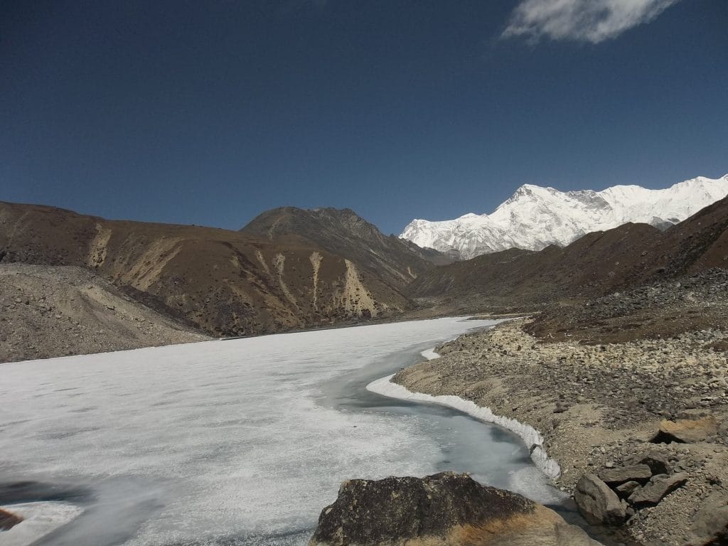
5. Cho Oyu – 8,188 meters / 26,864 feet
‘world sixth tallest and stunning peaks within Nepal and Tibet’
Overview:
Mt. Cho-Oyu is listed as the world’s 6th tallest peak that straddles the border of Nepal and Tibet / China. Mt. Cho-Oyu rises high above 8, 201 m and 29, 906 feet one of popular mountain for mountaineers.
Mt. Cho-Oyu first ascent in October 19th 1954 by Austrian Expedition supported by Nepalese expert climber Sherpa Pasang Dawa Lama.
Most of the climb to Mt. Cho-Oyu is done from southeast Tibet across the border, for easy access to reach the summit top than from Khumbu, Nepal side.
Mt. Cho-Oyu is located west of Mt. Everest at a mere distance of 20 km at Latitude 28.0960° North and Longitude 86.6615° towards East.
The name Cho-Oyu translates as “Turquoise Goddess” in Tibetan as well in the Sherpa language of Tibetan origin.
The mountain lies within the westernmost major peak of the Khumbu sub-section of the Mahalangur Himalaya and close to Gyachung Khang, the highest 7,000 m peak.
The area around Cho-Oyu in Nepal falls within the higher side of Khumbu towards further North of Gokyo 5th lakes. Mt. Cho-Oyu base camp is rarely visited by trekkers besides a few mountaineering expeditions due to its remote location.
From Tibet one can easily drive to the base camp of Mt. Cho-Oyu where the route leads past the main highway heading towards the southeast, one can catch awesome views of Mt. Cho-Oyu, Mt. Everest, and Mt. Shisapangma on the drive-in Tibet.
Mt. Cho-Oyu, which is also close to Nangpa-La a high pass that borders Tibet and Khumbu, Nepal where Tibetan still cross to Namche Bazaar on the Nepal side at Khumbu for trade.
Mt. Cho-Oyu from Khumbu best views from high Gokyo-Ri and great reflection of the mountain on its glacial crystal clear lakes at Gokyo.
Places to visit around Mt. Cho-Oyu in Khumbu, Nepal:
- Everest and Cho-Oyu Base Camp and climb of Kalapathar with Gokyo-Ro.
- Short trek to Gokyo valley and Tengboche Monastery for Everest Panorama.
- Gokyo Valley and the lakes with climb of Gokyo-Ri and visit to Gokyo 5th Lake near Cho-Oyu base camp.
- Gokyo Valley to Everest base camp via Cho-La Pass.
- Everest Three High Pass (Kongma, Cho-La and Renjo-La)
Places to visit around Mt. Cho-Oyu in Tibet:
- Drive from Kathmandu and visit Cho-Oyu base camp.
- Drive with option to visit Everest and Shisapangma base camps.
- Drive and fly from Lhasa, after visiting Cho-Oyu base camp.
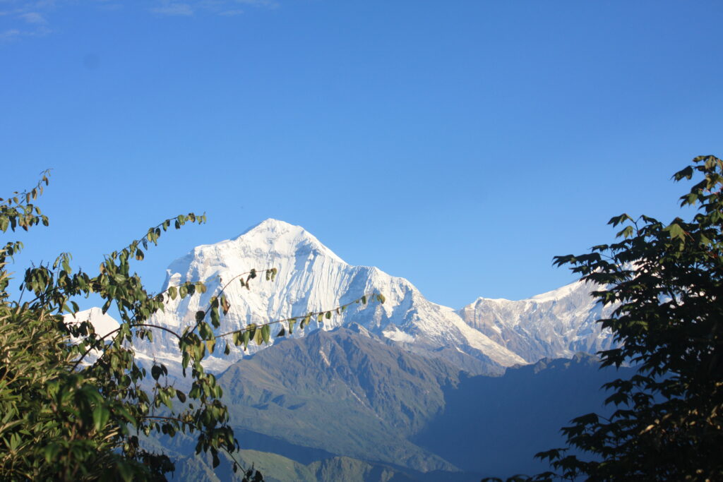
6. Dhaulagiri I – 8,167 meters / 26,795 feet
‘world 7th highest and massive bulk of a mountain range’
Overview:
Mt. Dhaulagiri, a massive mountain range located within Nepal Mid and Far West Himalaya, one of the few 8, 000 meters peaks situated wholly in Nepal.
Mt. Dhaulagiri stands as the world’s seventh-highest peak at the height of 8, 167 m and 26, 795 feet high, first conquest of Mt. Dhaulagiri in May 13th 1960 by Swiss and Austrian Expedition with support of Nepalese Sherpa guide Nima and Nawang Dorji.
Mt. Dhaulagiri can be seen clearly from Pokhara’s view-point hills towards the far western direction, situated west from the Annapurna Himalaya Mountain range.
Mt. Dhaulagiri with its group of peaks, namely Dhaulagiri-I, II, III, and IV with Gurja Himal, Mani-Pathi.
Mt. Dhaulagiri the highest peak within Nepal, which does not touch with any other country which is wholly in Nepal.
The word Dhaula comes from ancient Sanskrit meaning a dazzling white and Giri as mountain or peaks, situated on Latitude: 28° 41′ 28.19″ North and Longitude: 83° 29′ 25.79″ East.
Mt. Dhaulagiri a massive mountain range that extends 120 km from the Kaligandaki River west to the Bheri that touches the boundary with the Dolpo area.
This massif is bounded on the north and southwest by tributaries of the Bheri River and on the southeast by the Mygdi Khola continues towards Kaligandaki River in the east.
Mt. Dhaulagiri towers high on the opposite side of Mt. Annapurna to form the world’s deepest gorge of the Kaligandaki River.
Mt. Dhaulagiri since it was climbed in early 1960, where mountaineering expedition is still popular on high climbing season.
There are two main routes to reach its base camp at 4, 750 m high one from Marpha with climb over Thapa and Dhampus Pass to Hidden Valley and crossing high French Pass at above 5,360 m to reach its base camp.
The other routes from Beni town and Darbang, and trekking for a week to reach at base camp.
Places of interest to visit around Mt. Dhaulagiri:
- Around Dhaulagiri trek, Kaligandaki and Lower Mustang trek.
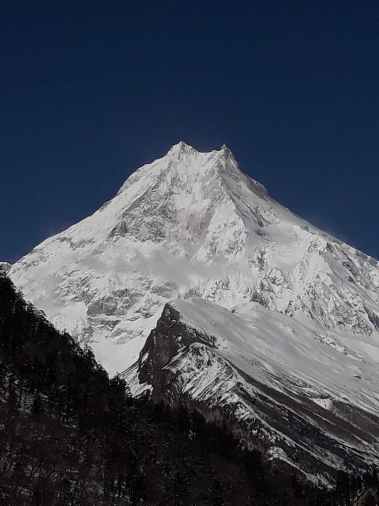
7. Manaslu – 8,163 meters / 26,781 feet
‘enjoy the great adventure on world’s eight highest peak’
Overview:
Mt. Manaslu ranked as the world’s eighth highest mountain, which is solely within Nepal. Located around Nepal North Mid-West Himalaya range close to Annapurna in the west with massive Ganesh Himal towards east.
Mt. Manaslu a striking looking peaks that towers high above at 8, 163 m and 26, 781 feet, first ascent on May 9th, 1956 by Japanese Expedition with Nepalese Sherpa guide Gyalzen Norbu.
From then on the mountain is frequently climbed by many mountaineers of different nationalities. The area around high Manaslu valley draws many trekkers and adventurers every high season of the year.
The word Manaslu comes from ancient Sanskrit language meaning mind or soul of the god, like Lake Manasarover in Tibet near Mt. Kailash.
The local native of Manaslu call as Kutung in Tibetan origin language which means a paradise. Mt. Manaslu coordinates at Latitude 8.5497° N and Longitude 84.5597° E.
Mt. Manaslu is clearly seen on route and as well from the famous touristic city Pokhara with its massive range of peaks.
Located within high areas of Gorkha district of Mid-West Nepal around Mansiri Himal range, also extends towards Lamjung and Manang districts.
Mt. Manaslu, getting more popular and attention since the last few decades, the upper and high Manaslu falls within a restricted area, due to its closeness with the Tibet frontier which is further due north.
Adventure to Mt. Manaslu offers great variation from low sub-tropic paddy fields towards cooler Himalayan hills covered with dense beautiful rhododendron and pine forest and then at arctic zone of remorseless fields of ice and glaciers.
The route to Mt. Manaslu and around situated on old Trans Himalaya Salt and Caravan Trail of Nepal and Tibet, where trade still exists but in smaller ways than in early 1950 and 60.
A great country to visit and to enjoy perfect wilderness in the harmony of scenic mountain views and local culture of Buddhism religion and heritage.
Place of interest around Mt. Manaslu:
- Around Manaslu a full circuit of 2 weeks duration, Tsum valley located east of Manaslu.
- One can enjoy extending on visiting Manaslu base camp and Larke-La pass towards Manang and beyond.
8. Annapurna I – 8,091 meters / 26,545 feet
‘famous and most popular destination Annapurna Himalaya among adventurer’
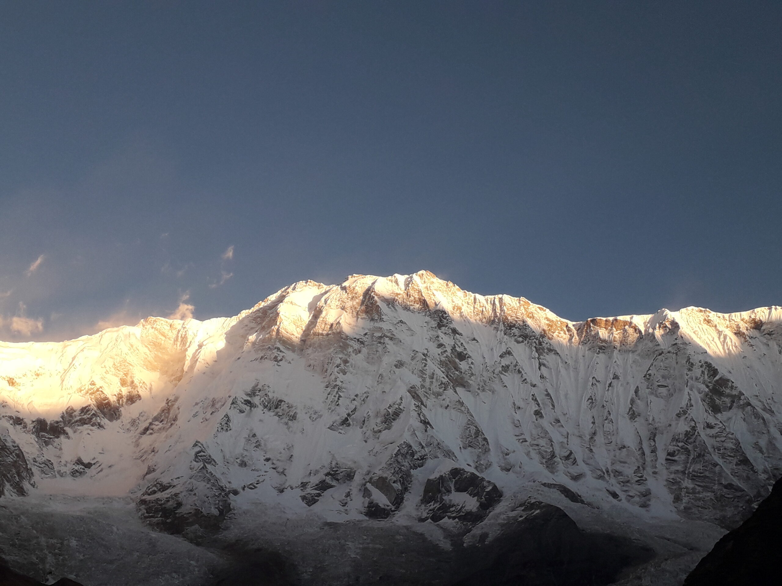
Overview:
Mt. Annapurna, a massive bulk of mountain range of North Mid-Western Himalaya that dominates the beautiful Pokhara valley, and reflects on its serene Phewa and Begnas Lakes.
Mt. Annapurna is listed as the world’s tenth highest mountain at an altitude above 8,091 m and 26, 545 feet high, located within north of Gandaki district of Nepal State-4, close to Manaslu in the east with Dhaulagiri towards west.
An amazing fact that Mt. Annapurna the first 8, 000-meter Mountain ever climbed in the history of mountaineering, it was summited in early June 3, 1950, and way ahead of Mt. Everest was conquered in 1953.
Mt. Annapurna ascent made by French Expedition lead by famous legendary Maurice Herzog and L. Lachenal. It is also a most challenging and technical mountain to climb.
The world Annapurna means Food / Crop-Enough (Anna for crops and Purna for enough), truly a great mountain in the Himalaya range.
Where the mountain glaciers feed the river system and irrigates the agriculture fields to yield more crops and food for the people, hence the divine name Annapurna.
Mt. Annapurna a massive range with striking peaks like Annapurna-I, II, III, and IV with Annapurna South, Huin-Chuli, Annapurna Fang / Vara Shikar and the famous Machhapuchare Himal known as Fish Tail peak, due to its twin summit top.
Annapurna and its magnificent range of peaks attracts trekkers, adventurers, and mountaineers in every peak season, one of the most visited regions in the Himalaya region.
Mt. Annapurna-I one of the most technically challenging mountain for mountaineers, a sheer ice and rocky wall of a mountain with an option of two routes for the climb.
The popular and main route from Annapurna Sanctuary and the other from Kaligandaki River southwest of Annapurna.
A wonderful adventure destination to Annapurna base camp from the sanctuary, walk from low warm paddy fields to cooler alpine hills and then reach at arctic cold within the midst of high giant peaks that surrounds you.
Many great places to visit around the Annapurna Himalaya range:
- Annapurna Circuit Trek Via high Thorong La Pass
- Annapurna Base Camp and the Sanctuary.
- Ghorepani and Poon Hill Sunrise Trek.
- Khopra and Khair Lake Trek.
- Mardi Himal Trek on the foot of Fish-Tail peak.